- Printed on Tyvek® (synthetic)
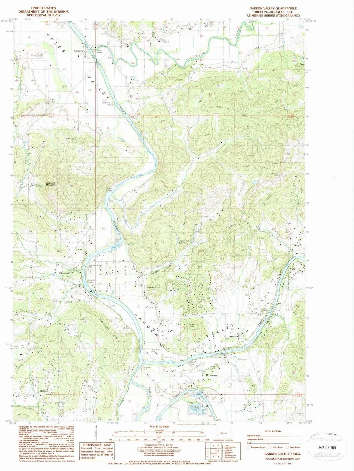
- USGS topographic map of Garden Valley, OR, at 1:24000 scale. Lighter material. Waterproof. Tear-resistant. Foldable. Very durable. Perfect for backpacking and the outdoors.
- Cities, towns, villages: Umpqua,Elgarose,Riversdale,Cleveland
- Mountains: Red Hill,Coyote Hill,Cleveland Hill,Woodruff Mountain
- Valleys: Garden Valley,Champagne Creek Valley
USGS topographic map of Garden Valley, Oregon, dated 1987, updated 1987.
Includes geographic coordinates (latitude and longitude), lines of elevation, bodies of water, roads, and more. This topo quad is suitable for recreational, outdoor uses, office applications, or wall map framing.
Printed on-demand by YellowMaps on the print material of your choice.
Shipping rolled from Minneapolis, MN, United States.
Product Number: USGS-5418606
Map Size: 26.7 inches high x 21.9 inches wide
Map Scale: 1:24000
Map Type: POD USGS Topographic Map
Map Series: HTMC
Map Version: Historical
Cell ID: 16813
Scan ID: 279984
Imprint Year: 1987
Woodland Tint: Yes
Aerial Photo Year: 1982
Edit Year: 1987
Field Check Year: 1983
Datum: NAD27
Map Projection: Lambert Conformal Conic
Provisional map: Yes
Map published by United States Geological Survey
Map Language: English
Scanner Resolution: 600 dpi
Map Cell Name: Garden Valley
Grid size: 7.5 X 7.5 Minute
Date on map: 1987
Geographical region: Oregon, United States
Northern map edge Latitude: 43.375°
Southern map edge Latitude: 43.25°
Western map edge Longitude: -123.5°
Eastern map edge Longitude: -123.375°
Surrounding map sheets (copy & paste the Product No. in the search bar):
North: USGS-5422472
East: USGS-5422854
South: USGS-5545284,USGS-5421298,USGS-5545286,USGS-5545282,USGS-5545288
West: USGS-5417150,USGS-5545552,USGS-5545548,USGS-5545550
")


")


