- Printed on Tyvek® (synthetic)
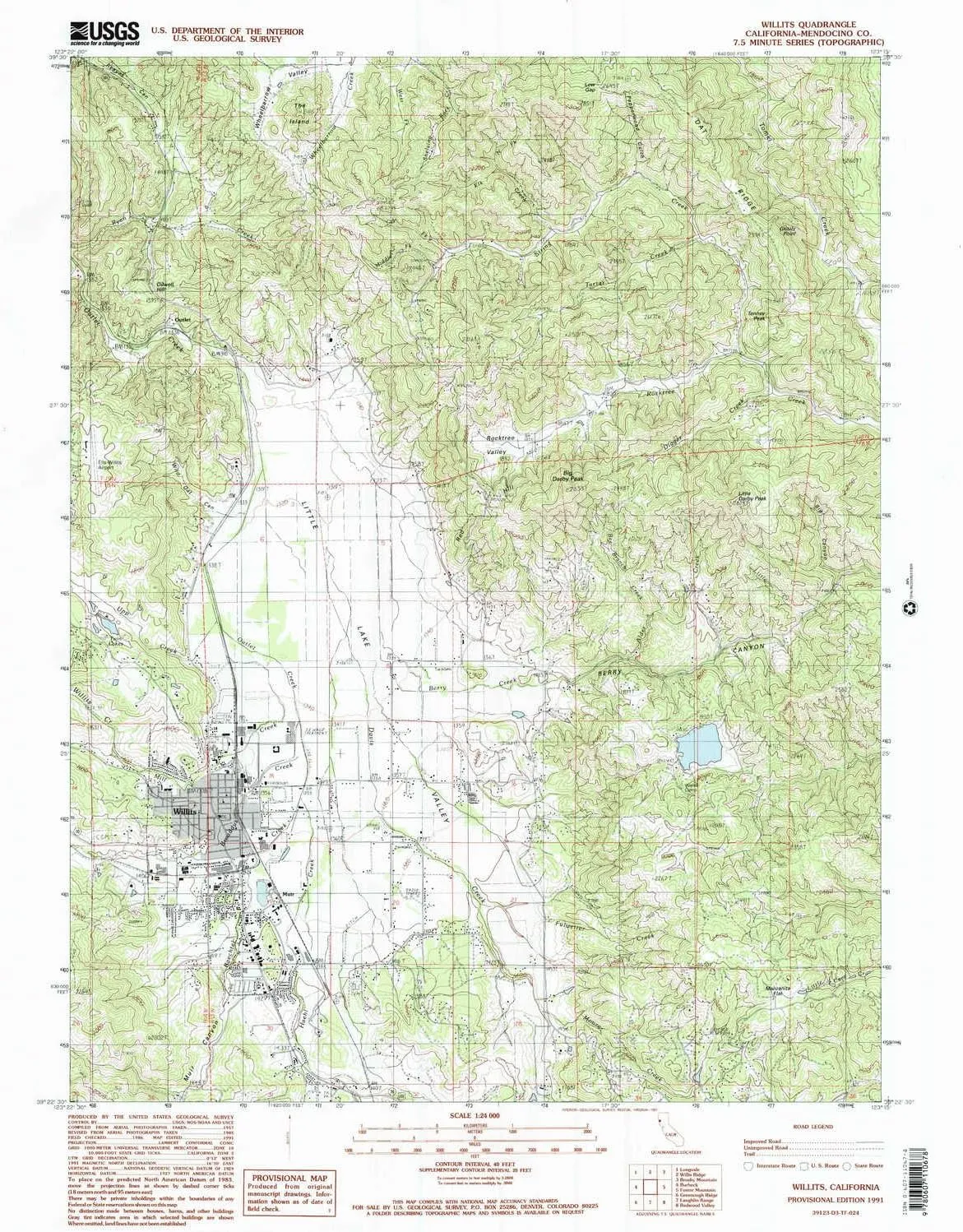
- USGS topographic map of Willits, CA, at 1:24000 scale. Lighter material. Waterproof. Tear-resistant. Foldable. Very durable. Perfect for backpacking and the outdoors.
- Cities, towns, villages: Upp,Willits,Fair Oaks,Simerson,DeCamp,Muir
- Mountains: Grizzly Point,The Island,Tenney Peak,Little Darby Peak,Big Darby Peak
- Valleys: Little Lake Valley,Wild Oat Canyon,Pepperwood Gulch,Muir Canyon,Berry Canyon,Big Canyon
USGS topographic map of Willits, California, dated 1991, updated 1991.
Includes geographic coordinates (latitude and longitude), lines of elevation, bodies of water, roads, and more. This topo quad is suitable for recreational, outdoor uses, office applications, or wall map framing.
Printed on-demand by YellowMaps on the print material of your choice.
Shipping rolled from Minneapolis, MN, United States.
Product Number: USGS-5526241
Map Size: 26.7 inches high x 21.4 inches wide
Map Scale: 1:24000
Map Type: POD USGS Topographic Map
Map Series: HTMC
Map Version: Historical
Cell ID: 49216
Scan ID: 102562
Imprint Year: 1991
Woodland Tint: Yes
Aerial Photo Year: 1985
Edit Year: 1991
Field Check Year: 1986
Datum: NAD27
Map Projection: Lambert Conformal Conic
Provisional map: Yes
Map published by United States Geological Survey
Map Language: English
Scanner Resolution: 600 dpi
Map Cell Name: Willits
Grid size: 7.5 X 7.5 Minute
Date on map: 1991
Geographical region: California, United States
Northern map edge Latitude: 39.5°
Southern map edge Latitude: 39.375°
Western map edge Longitude: -123.375°
Eastern map edge Longitude: -123.25°
Surrounding map sheets (copy & paste the Product No. in the search bar):
North: USGS-5526235,USGS-5526237,USGS-5526239
East: USGS-5514091,USGS-5514089
South: USGS-5517081
West: USGS-5509487


, Portable Travel Bag Pouch for Switch 2 Console & Accessories, Protective Hard Shell Switch 2 Accessories Bundle, Large Capacity Storage")


")
