- Printed on Polypropylene (plastic)
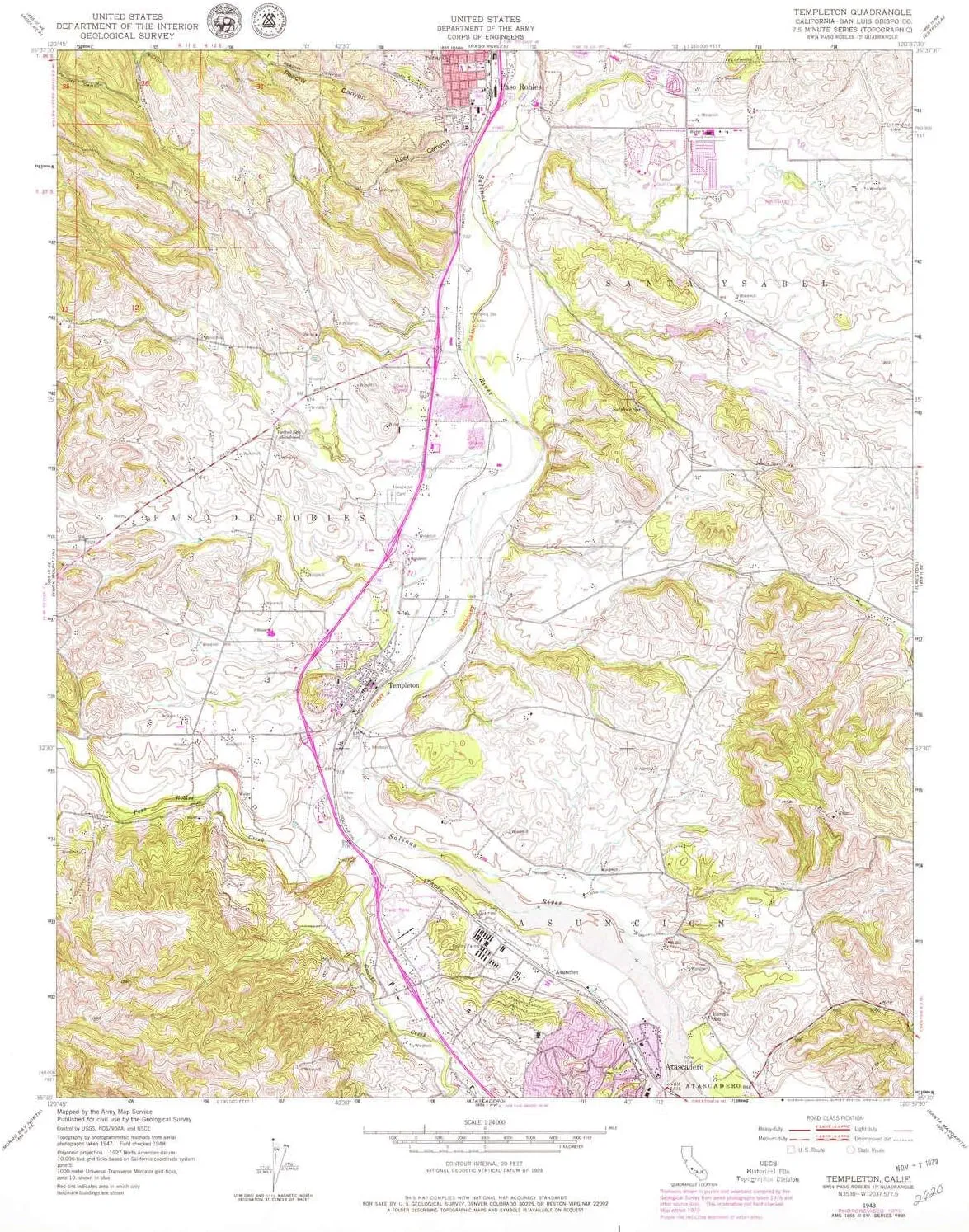
- USGS topographic map of Templeton, CA, at 1:24000 scale. Heavier material. Waterproof. Tear-resistant. Foldable. Perfect for the outdoors.
- Cities, towns, villages: Asuncion,Templeton
- Islands: Consult topo map preview for visible islands.
- Parks and forests: Melody Park,Sherwood Park,Caso Robles Park,Robbins Field Ball Park,Centennial Park and Swimming Pool,Royal Oaks Park,Templeton Athletic Fields,Turtle Creek Park
USGS topographic map of Templeton, California, dated 1948, updated 1979.
Includes geographic coordinates (latitude and longitude), lines of elevation, bodies of water, roads, and more. This topo quad is suitable for recreational, outdoor uses, office applications, or wall map framing.
Printed on-demand by YellowMaps on the print material of your choice.
Shipping rolled from Minneapolis, MN, United States.
Product Number: USGS-5524453
Map Size: 26.9 inches high x 22 inches wide
Map Scale: 1:24000
Map Type: POD USGS Topographic Map
Map Series: HTMC
Map Version: Historical
Cell ID: 44527
Scan ID: 300839
Imprint Year: 1979
Woodland Tint: Yes
Visual Version Number: 1
Photo Revision Year: 1979
Aerial Photo Year: 1976
Edit Year: 1979
Field Check Year: 1948
Datum: NAD27
Map Projection: Polyconic
Map published by United States Geological Survey
Map published by United States Army Corps of Engineers
Map published by United States Army
Map Language: English
Scanner Resolution: 600 dpi
Map Cell Name: Templeton
Grid size: 7.5 X 7.5 Minute
Date on map: 1948
Geographical region: California, United States
Northern map edge Latitude: 35.625°
Southern map edge Latitude: 35.5°
Western map edge Longitude: -120.75°
Eastern map edge Longitude: -120.625°
Surrounding map sheets (copy & paste the Product No. in the search bar):
North: USGS-5520471,USGS-5520469,USGS-5520467,USGS-5520465
East: USGS-5511809,USGS-5511817,USGS-5511813,USGS-5511811,USGS-5511815
South: USGS-5507773,USGS-5504233,USGS-5504237,USGS-5507767,USGS-5504239
West: USGS-5500299,USGS-5526459,USGS-5500297,USGS-5526461,USGS-5500291


")


 - Defender Series Case - Mountain Majesty (Purple) - Rugged & Durable - with Port Protection - Case Only - Non-Retail Packaging")


