- Printed on Polypropylene (plastic)
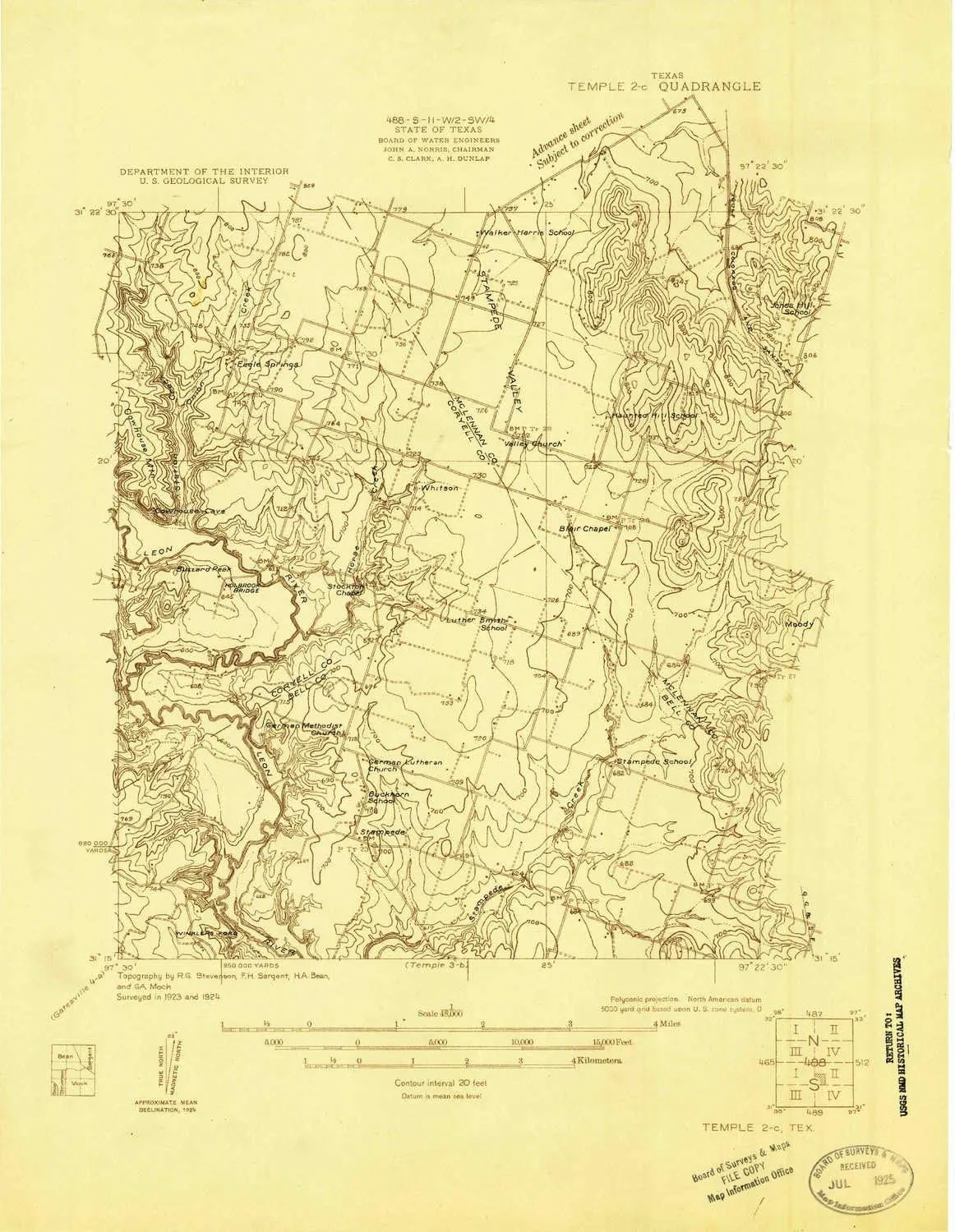
- USGS topographic map of Temple 2 C, TX, at 1:48000 scale. Heavier material. Waterproof. Tear-resistant. Foldable. Perfect for the outdoors.
- Cities, towns, villages: Whitson,Stampede,Meador Grove
- Islands: Consult topo map preview for visible islands.
- Parks and forests: Mother Neff State Park,Iron Bridge Wildlife Management Area,Horseshoe Bend Wildlife Management Area,Iron Bridge Park
USGS topographic map of Temple 2 C, Texas, dated 1924.
Includes geographic coordinates (latitude and longitude), lines of elevation, bodies of water, roads, and more. This topo quad is suitable for recreational, outdoor uses, office applications, or wall map framing.
Printed on-demand by YellowMaps on the print material of your choice.
Shipping rolled from Minneapolis, MN, United States.
Product Number: USGS-5678950
Map Size: 18.8 inches high x 14.5 inches wide
Map Scale: 1:48000
Map Type: POD USGS Topographic Map
Map Series: HTMC
Map Version: Historical
Cell ID: 13284
Scan ID: 137508
Visual Version Number: 1
Survey Year: 1924
Datum: NAD
Map Projection: Polyconic
Advance: Yes
Map published by United States Geological Survey
Keywords: Nonstandard Press Run; Overedge
Map Language: English
Scanner Resolution: 600 dpi
Map Cell Name: Eagle Springs
Grid size: 7.5 X 7.5 Minute
Date on map: 1924
Geographical region: Texas, United States
Northern map edge Latitude: 31.375°
Southern map edge Latitude: 31.25°
Western map edge Longitude: -97.5°
Eastern map edge Longitude: -97.375°
Surrounding map sheets (copy & paste the Product No. in the search bar):
North: USGS-5490175,USGS-5490177
East: USGS-5490639,USGS-5490641,USGS-5490643
South: USGS-5490555,USGS-5679961,USGS-5490559,USGS-5678952,USGS-5490557
West: USGS-5478503,USGS-5489243,USGS-5489235,USGS-5489239,USGS-5489241


, 2.25 Offset In/ 2.25 Center Out - Moderate Sound")


