- Printed on Polypropylene (plastic)
- USGS topographic map of Talkeetna Mountains B 5, AK, at 1:63360 scale. Heavier material. Waterproof. Tear-resistant. Foldable. Perfect for the outdoors.
- Cities, towns, villages: Please see map preview to find populated places, townships, as well as roads and street names if available.
- Islands: Consult topo map preview for visible islands.
- Parks and forests: National Parks, National Forests, etc. Please preview map image for specifics.
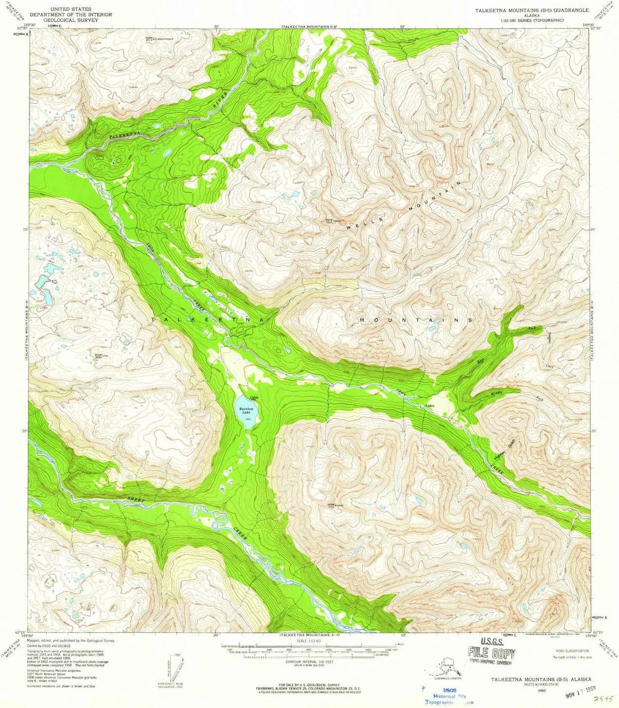
USGS topographic map of Talkeetna Mountains B 5, Alaska, dated 1950, updated 1959.
Includes geographic coordinates (latitude and longitude), lines of elevation, bodies of water, roads, and more. This topo quad is suitable for recreational, outdoor uses, office applications, or wall map framing.
Printed on-demand by YellowMaps on the print material of your choice.
Shipping rolled from Minneapolis, MN, United States.
Product Number: USGS-5673868
Map Size: 20.8 inches high x 18 inches wide
Map Scale: 1:63360
Map Type: POD USGS Topographic Map
Map Series: HTMC
Map Version: Historical
Cell ID: 63279
Scan ID: 359635
Imprint Year: 1959
Woodland Tint: Yes
Aerial Photo Year: 1957
Datum: NAD27
Map Projection: Universal Transverse Mercator
Map published by United States Geological Survey
Map Language: English
Scanner Resolution: 600 dpi
Map Cell Name: Talkeetna Mountains B-5
Grid size: 15 X 15 Minute
Date on map: 1950
Geographical region: Alaska, United States
Northern map edge Latitude: 62.5°
Southern map edge Latitude: 62.25°
Western map edge Longitude: -149.5°
Eastern map edge Longitude: -149°
Surrounding map sheets (copy & paste the Product No. in the search bar):
North: USGS-5673922,USGS-5673918,USGS-5673920
East: USGS-5673866,USGS-5673862,USGS-5673864,USGS-5673860
South: USGS-5673816,USGS-5673818,USGS-5673822,USGS-5673820
West: USGS-5673878,USGS-5673876,USGS-5673882,USGS-5673884,USGS-5673880


 Size 1")


