- Printed on Tyvek® (synthetic)
- USGS topographic map of Solstice Canyon, CA, at 1:24000 scale. Lighter material. Waterproof. Tear-resistant. Foldable. Very durable. Perfect for backpacking and the outdoors.
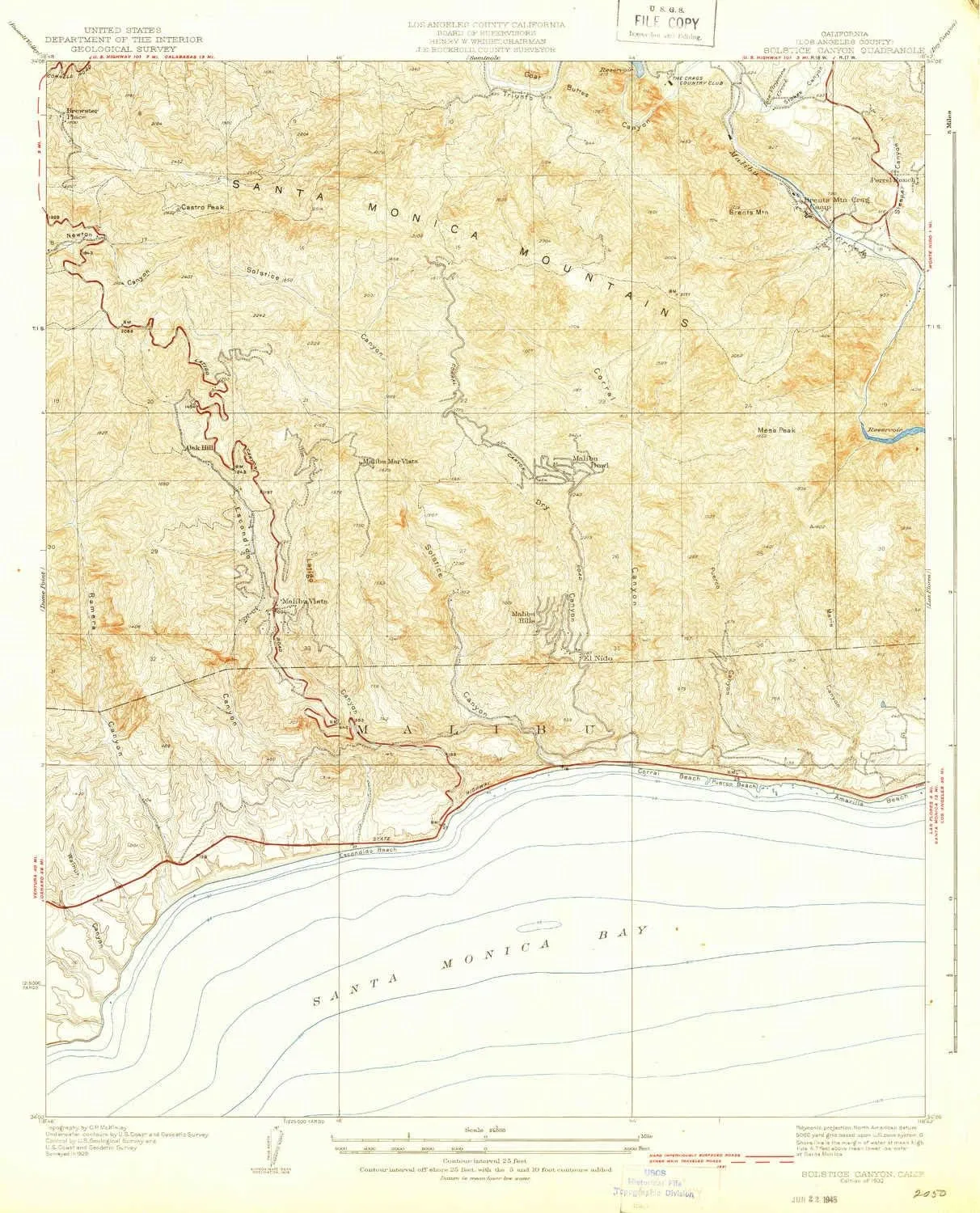
- Cities, towns, villages: El Nido,Malibu Bowl,Malibu Mar Vista (historical),Malibu Hills,Malibu Vista,Oak Hill
- Mountains: Mesa Peak,Brents Mountain,Castro Peak,Solstice Hill,McAuley Peak,Goat Buttes
- Valleys: Solstice Canyon,Sleeper Canyon,Corral Canyon,Walnut Canyon,Escondido Canyon,Ramirez Canyon,Marle Canyon,Dry Canyon,Puerco Canyon,Triunfo Canyon,Latigo Canyon,Stokes Canyon
USGS topographic map of Solstice Canyon, California, dated 1932.
Includes geographic coordinates (latitude and longitude), lines of elevation, bodies of water, roads, and more. This topo quad is suitable for recreational, outdoor uses, office applications, or wall map framing.
Printed on-demand by YellowMaps on the print material of your choice.
Shipping rolled from Minneapolis, MN, United States.
Product Number: USGS-5658031
Map Size: 20.9 inches high x 16.9 inches wide
Map Scale: 1:24000
Map Type: POD USGS Topographic Map
Map Series: HTMC
Map Version: Historical
Cell ID: 395897
Scan ID: 295259
Visual Version Number: 1
Survey Year: 1929
Datum: NAD
Map Projection: Polyconic
Map published by United States Geological Survey
Map Language: English
Scanner Resolution: 600 dpi
Map Cell Name: Solstice Canyon
Grid size: 7.5 X 7.5 Minute
Date on map: 1932
Geographical region: California, United States
Northern map edge Latitude: 34.1°
Southern map edge Latitude: 34°
Western map edge Longitude: -118.8°
Eastern map edge Longitude: -118.7°
Surrounding map sheets (copy & paste the Product No. in the search bar):
North: USGS-5657985,USGS-5657983,USGS-5658103
East: USGS-5657668,USGS-5657670
South:
West: USGS-5657524,USGS-5657526,USGS-5657528


