- Printed on Polypropylene (plastic)
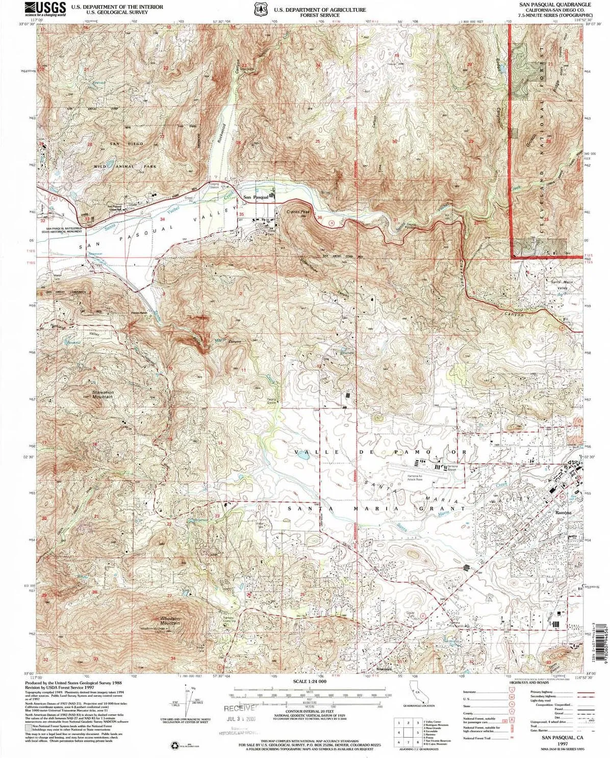
- USGS topographic map of San Pasqual, CA, at 1:24000 scale. Heavier material. Waterproof. Tear-resistant. Foldable. Perfect for the outdoors.
- Cities, towns, villages: San Pasqual,Rosemont
- Islands: Consult topo map preview for visible islands.
- Parks and forests: San Pasqual Battlefield State Historic Park,San Diego Wild Animal Park
USGS topographic map of San Pasqual, California, dated 1997, updated 2000.
Includes geographic coordinates (latitude and longitude), lines of elevation, bodies of water, roads, and more. This topo quad is suitable for recreational, outdoor uses, office applications, or wall map framing.
Printed on-demand by YellowMaps on the print material of your choice.
Shipping rolled from Minneapolis, MN, United States.
Product Number: USGS-5522597
Map Size: 26.8 inches high x 21.9 inches wide
Map Scale: 1:24000
Map Type: POD USGS Topographic Map
Map Series: HTMC
Map Version: Historical
Cell ID: 39687
Scan ID: 295037
Imprint Year: 2000
Woodland Tint: Yes
Aerial Photo Year: 1994
Edit Year: 1997
Datum: NAD27
Map Projection: Lambert Conformal Conic
Map published by United States Geological Survey
Map published by United States Forest Service
Map Language: English
Scanner Resolution: 600 dpi
Map Cell Name: San Pasqual
Grid size: 7.5 X 7.5 Minute
Date on map: 1997
Geographical region: California, United States
Northern map edge Latitude: 33.125°
Southern map edge Latitude: 33°
Western map edge Longitude: -117°
Eastern map edge Longitude: -116.875°
Surrounding map sheets (copy & paste the Product No. in the search bar):
North: USGS-5521907,USGS-5521917,USGS-5521911,USGS-5521915,USGS-5521913
East: USGS-5521355,USGS-5521367,USGS-5521365,USGS-5521361,USGS-5521359
South: USGS-5522675,USGS-5505731,USGS-5505735,USGS-5501617,USGS-5501593
West: USGS-5506265,USGS-5506257,USGS-5506267,USGS-5513575,USGS-5501677


, Rugged & Durable, with Port Protection, Includes Holster Clip Kickstand")


