- Printed on Tyvek® (synthetic)
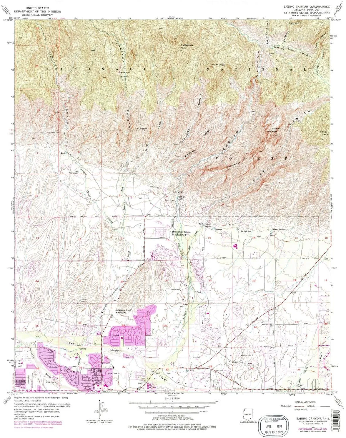
- USGS topographic map of Sabino Canyon, AZ, at 1:24000 scale. Lighter material. Waterproof. Tear-resistant. Foldable. Very durable. Perfect for backpacking and the outdoors.
- Cities, towns, villages: Indian Ridge Estates,Tucson Country Club Estates
- Mountains: Saddleback,Mount Miguel,Thimble Peak,Rattlesnake Peak,Whaleback
- Valleys: Rattlesnake Canyon,Breakfast Canyon,Ventana Canyon,Esperero Canyon,Bird Canyon,Box Camp Canyon,Palisade Canyon,Pine Canyon,Sabino Canyon,East Fork Sabino Canyon,Bear Canyon
USGS topographic map of Sabino Canyon, Arizona, dated 1957, updated 1977.
Includes geographic coordinates (latitude and longitude), lines of elevation, bodies of water, roads, and more. This topo quad is suitable for recreational, outdoor uses, office applications, or wall map framing.
Printed on-demand by YellowMaps on the print material of your choice.
Shipping rolled from Minneapolis, MN, United States.
Product Number: USGS-5555506
Map Size: 27 inches high x 22 inches wide
Map Scale: 1:24000
Map Type: POD USGS Topographic Map
Map Series: HTMC
Map Version: Historical
Cell ID: 39101
Scan ID: 313174
Imprint Year: 1977
Woodland Tint: Yes
Photo Revision Year: 1975
Aerial Photo Year: 1975
Survey Year: 1957
Datum: NAD27
Map Projection: Polyconic
Map published by United States Geological Survey
Map Language: English
Scanner Resolution: 600 dpi
Map Cell Name: Sabino Canyon
Grid size: 7.5 X 7.5 Minute
Date on map: 1957
Geographical region: Arizona, United States
Northern map edge Latitude: 32.375°
Southern map edge Latitude: 32.25°
Western map edge Longitude: -110.875°
Eastern map edge Longitude: -110.75°
Surrounding map sheets (copy & paste the Product No. in the search bar):
North: USGS-5554238,USGS-5554236,USGS-5554240,USGS-5554168
East: USGS-5549726,USGS-5547480,USGS-5549722,USGS-5547484,USGS-5549724
South: USGS-5556760,USGS-5556748,USGS-5556758,USGS-5556746,USGS-5556752
West: USGS-5556770,USGS-5556772,USGS-5556764,USGS-5556762,USGS-5556766


