- Printed on Polypropylene (plastic)
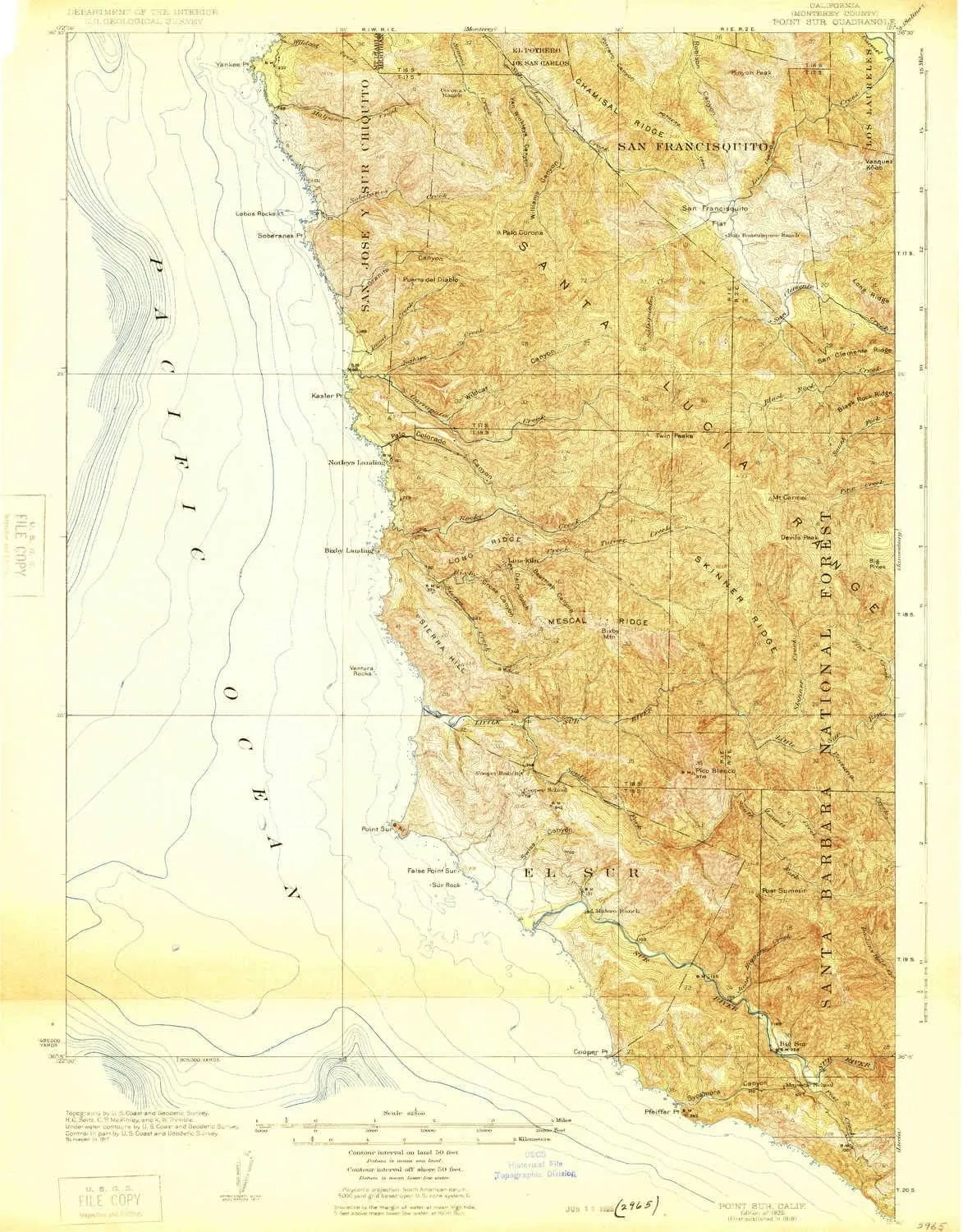
- USGS topographic map of Point Sur, CA, at 1:62500 scale. Heavier material. Waterproof. Tear-resistant. Foldable. Perfect for the outdoors.
- Cities, towns, villages: Notleys Landing,Big Sur
- Islands: Yankee Point Rock,Lobos Rocks,Franciscan Rocks,Ventura Rocks,Castle Rock
- Parks and forests: Garrapata State Park,Point Sur State Historic Park,Andrew Molera State Park,Point Sur Lighthouse Reservation
USGS topographic map of Point Sur, California, dated 1925.
Includes geographic coordinates (latitude and longitude), lines of elevation, bodies of water, roads, and more. This topo quad is suitable for recreational, outdoor uses, office applications, or wall map framing.
Printed on-demand by YellowMaps on the print material of your choice.
Shipping rolled from Minneapolis, MN, United States.
Product Number: USGS-5683033
Map Size: 21 inches high x 16.5 inches wide
Map Scale: 1:62500
Map Type: POD USGS Topographic Map
Map Series: HTMC
Map Version: Historical
Cell ID: 61122
Scan ID: 298625
Woodland Tint: Yes
Survey Year: 1917
Datum: NAD
Map Projection: Polyconic
Map published by United States Geological Survey
Keywords: Overedge with No Adjacent Map
Map Language: English
Scanner Resolution: 600 dpi
Map Cell Name: Point Sur
Grid size: 15 X 15 Minute
Date on map: 1925
Geographical region: California, United States
Northern map edge Latitude: 36.5°
Southern map edge Latitude: 36.25°
Western map edge Longitude: -122°
Eastern map edge Longitude: -121.75°
Surrounding map sheets (copy & paste the Product No. in the search bar):
North: USGS-5503077,USGS-5503065,USGS-5503071,USGS-5657757,USGS-5503067
East: USGS-5500261,USGS-5502349,USGS-5502345,USGS-5502353,USGS-5502341
South:
West:


