- Printed on Polypropylene (plastic)
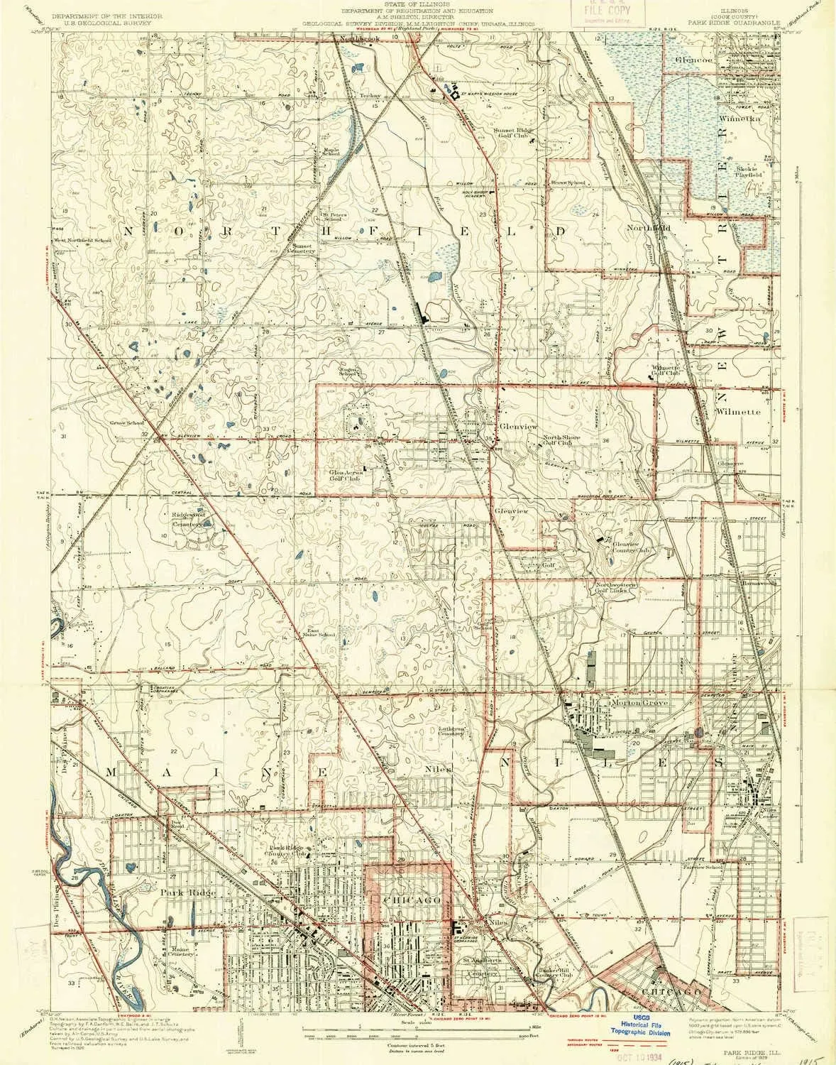
- USGS topographic map of Park Ridge, IL, at 1:24000 scale. Heavier material. Waterproof. Tear-resistant. Foldable. Perfect for the outdoors.
- Cities, towns, villages: Royal Court,Stonebrook,Michealsen Subdivision,Pine Grove,Orchard Subdivision,Kimberleigh,Niles,Highcrest,Woodmere Subdivision,Arrowhead,Skiersch's Subdivision,Fox Hedge,Wahl's Subdivision,Fox Run,Landwehr Estates,Oliver Lane Subdivision,Highland Woods,Birch Pond,Westfield,Northbrook Greens,Maryland Subdivision,Heathercrest,Dorothy Stirling Subdivision,Rozenow's Subdivision,Stonehedge Glen,Stone Hedge Manor,Stonegate,Sunset Court,Porters Glenview Subdivision
- Islands: Consult topo map preview for visible islands.
- Parks and forests: Hawthorne Glen Park,Nelson School Park,Jackman Park,Meadowhill Park,Gross Point Park,Flick Park,Huber Lane Park,Northbrook Sports Complex,Skokie Park Tennis Center,Edgewood Park,Lockwood Park,Oriole Park,Maine Park,Johns Park,Glenbrook North High School Prairie Nature Preserve,Northwest Park,West Park,G G Rowell Park,Prairie View Park,Wildwood Park,Chesterfield Gardens Park,Sequoia Park,Searle Park,Jennings Park,Village Green Park,Messiah Park,Tall Trees Park
USGS topographic map of Park Ridge, Illinois, dated 1929.
Includes geographic coordinates (latitude and longitude), lines of elevation, bodies of water, roads, and more. This topo quad is suitable for recreational, outdoor uses, office applications, or wall map framing.
Printed on-demand by YellowMaps on the print material of your choice.
Shipping rolled from Minneapolis, MN, United States.
Product Number: USGS-5529751
Map Size: 24.8 inches high x 19.4 inches wide
Map Scale: 1:24000
Map Type: POD USGS Topographic Map
Map Series: HTMC
Map Version: Historical
Cell ID: 34230
Scan ID: 308428
Survey Year: 1926
Datum: NAD
Map Projection: Polyconic
Map published by United States Geological Survey
Map Language: English
Scanner Resolution: 600 dpi
Map Cell Name: Park Ridge
Grid size: 7.5 X 7.5 Minute
Date on map: 1929
Geographical region: Illinois, United States
Northern map edge Latitude: 42.125°
Southern map edge Latitude: 42°
Western map edge Longitude: -87.875°
Eastern map edge Longitude: -87.75°
Surrounding map sheets (copy & paste the Product No. in the search bar):
North: USGS-5676826,USGS-5676836,USGS-5676838,USGS-5676834,USGS-5676830
East: USGS-5528037,USGS-5930127,USGS-5528049,USGS-5528043,USGS-5930125
South: USGS-5530103,USGS-5530111,USGS-5530099,USGS-5530107,USGS-5530119
West: USGS-5526833,USGS-5526827,USGS-5526819,USGS-5526821,USGS-5526825


