- Printed on Polypropylene (plastic)
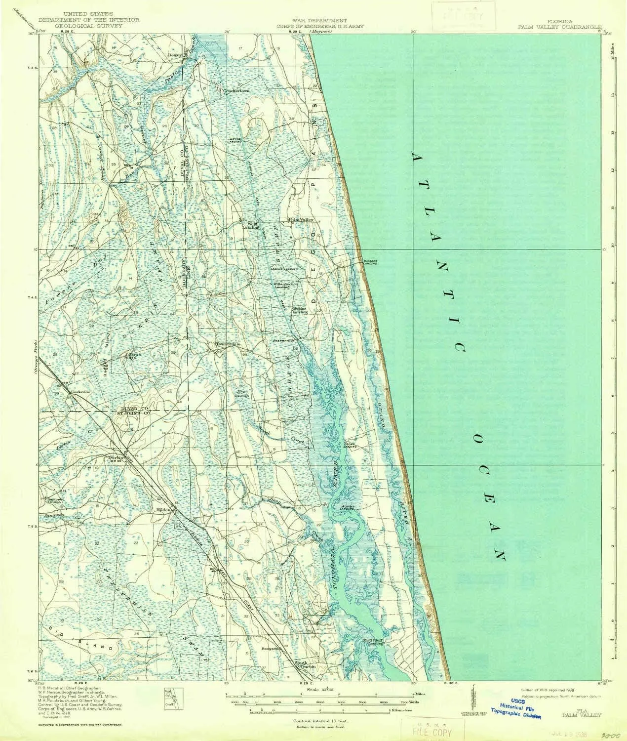
- USGS topographic map of Palm Valley, FL, at 1:62500 scale. Heavier material. Waterproof. Tear-resistant. Foldable. Perfect for the outdoors.
- Cities, towns, villages: Ponte Vedra,Tolomato (historical),Palm Valley Landing,Twentymile,Clarksville,Ponte Vedra Beach,Durbin,Mickler Landing,South Ponte Vedra Beach,Palm Valley,Sawgrass,Hilden
- Islands: Pine Island,Little Pine Island,Ragged Island,Big Island,Medicis Island
- Parks and forests: Guana River State Park
USGS topographic map of Palm Valley, Florida, dated 1918, updated 1938.
Includes geographic coordinates (latitude and longitude), lines of elevation, bodies of water, roads, and more. This topo quad is suitable for recreational, outdoor uses, office applications, or wall map framing.
Printed on-demand by YellowMaps on the print material of your choice.
Shipping rolled from Minneapolis, MN, United States.
Product Number: USGS-5621444
Map Size: 20 inches high x 16.9 inches wide
Map Scale: 1:62500
Map Type: POD USGS Topographic Map
Map Series: HTMC
Map Version: Historical
Cell ID: 60720
Scan ID: 347981
Imprint Year: 1938
Survey Year: 1917
Datum: NAD
Map Projection: Polyconic
Map published by United States Geological Survey
Map published by United States Army Corps of Engineers
Map published by United States Department of War
Map Language: English
Scanner Resolution: 600 dpi
Map Cell Name: Palm Valley
Grid size: 15 X 15 Minute
Date on map: 1918
Geographical region: Florida, United States
Northern map edge Latitude: 30.25°
Southern map edge Latitude: 30°
Western map edge Longitude: -81.5°
Eastern map edge Longitude: -81.25°
Surrounding map sheets (copy & paste the Product No. in the search bar):
North: USGS-5625194,USGS-5625192,USGS-5625206,USGS-5625212,USGS-5625202
East:
South: USGS-5647729,USGS-5689166,USGS-5622102,USGS-5622100,USGS-5689168
West: USGS-5626902,USGS-5626900,USGS-5621422,USGS-5626904,USGS-5621418


