- CLASSY MAP IN OFFICE OR HOME: You can't go wrong with this beautiful production from National Geographic. A guaranteed conversation piece!
- A MUST-HAVE FOR COLLECTORS: This map is a beautiful representation of Cold War-era cartography with the distinct colors and cartographic style of the National Geographic maps of today.
- QUALITY PRINT: Printed on Polypropylene for rich clear colour and legibility. Makes for a beautiful product on your home, school or office wall.
- DURABLE MATERIAL: This quality print material won't easily crease or tear in shipping or with use
- ICONIC CARTOGRAPHY: National Geographic's maps are the standard others are measured against. You can count on this product having the highest quality content and display in the industry.
Own a piece of 20th century history with this vintage map!
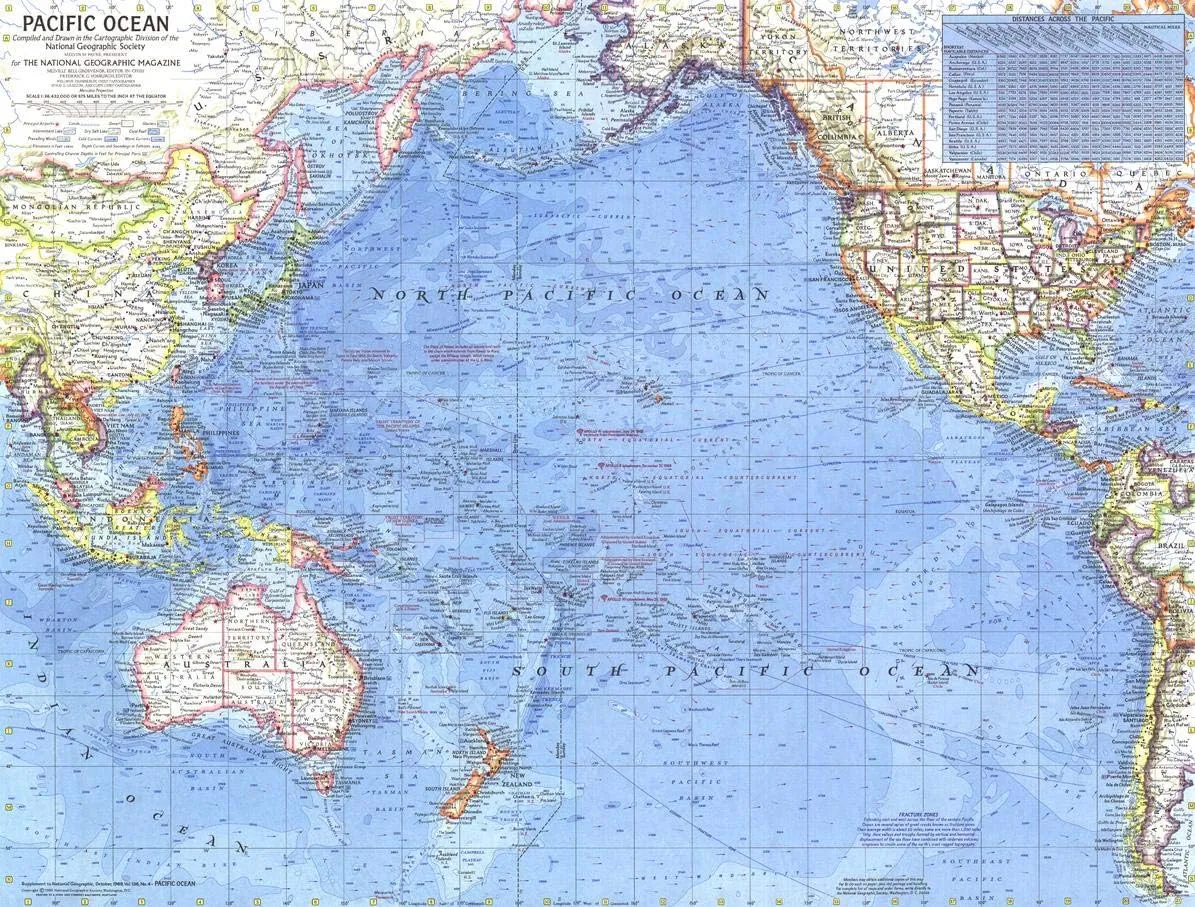
"Conflict on earth, conquest of space." Hidden in the mosaic of the vivid greens, yellows and pinks of this 1969 map of the Pacific Ocean are the conflicts that plagued the Earth in the decades that followed World War II. Clashes with the Soviet Union, China, North Korea, and the persisting Vietnam War were playing out with devastating effect on this brightly-colored map that exhibits National Geographic's iconic cartography.
Distances between major cities and a wealth of historical notes provide nuance to this map. Most notable are the splashdown points of the Apollo missions in 1969 - including the heralded Apollo 11 mission that saw Neil Armstrong and Buzz Aldrin take humanity's first steps on the moon. The intricate detailing of this map of the Pacific highlights the explosion of technological innovation and new geographic discoveries of the era.
This map is drawn in the Mercator projection, the standard map projection for navigation because of its unique property of representing any course of constant bearing as a straight segment.
A must have for historians interested in mid-century history and exploration, this map is a unique conversation piece on its own or with other mid-20th century works: track the evolution of National Geographic's legendary cartography and of political boundaries with companion pieces from the 1920s to 1980s!
Printed on polypropylene, an ideal material for wall maps as the printing brings out rich colours, and crisp edges for readability. The material is stronger than most papers and unlikely to crease or rip. The matte finish eliminates glare, and adds texture to the map. Ideal for display.


