- Printed on Polypropylene (plastic)
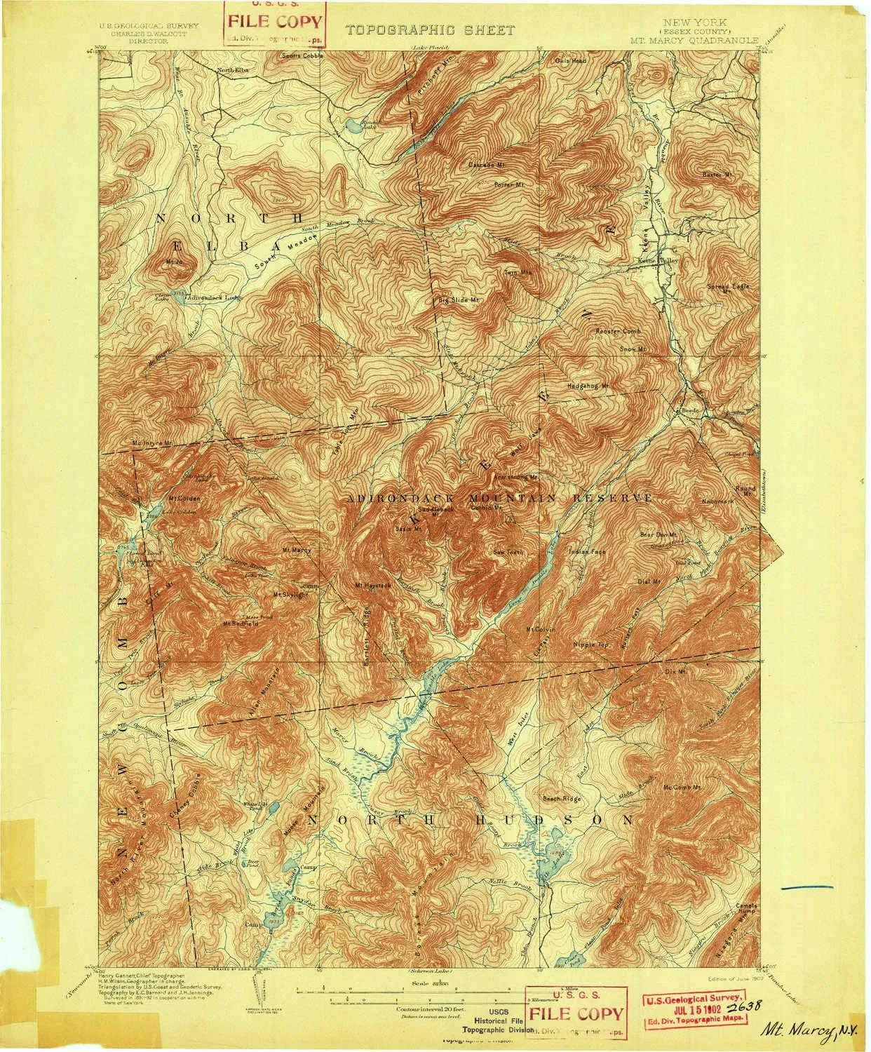
- USGS topographic map of Mt Marcy, NY, at 1:62500 scale. Heavier material. Waterproof. Tear-resistant. Foldable. Perfect for the outdoors.
- Cities, towns, villages: Keene Valley,Saint Huberts,North Elba,Shady Corner Curve
- Islands: Consult topo map preview for visible islands.
- Parks and forests: Mount Van Hoevenburg Recreation Area
USGS topographic map of Mt Marcy, New York, dated 1902.
Includes geographic coordinates (latitude and longitude), lines of elevation, bodies of water, roads, and more. This topo quad is suitable for recreational, outdoor uses, office applications, or wall map framing.
Printed on-demand by YellowMaps on the print material of your choice.
Shipping rolled from Minneapolis, MN, United States.
Product Number: USGS-5659210
Map Size: 20.1 inches high x 16.6 inches wide
Map Scale: 1:62500
Map Type: POD USGS Topographic Map
Map Series: HTMC
Map Version: Historical
Cell ID: 58048
Scan ID: 144110
Visual Version Number: 1
Survey Year: 1892
Datum: Unstated
Map Projection: Unstated
Map published by United States Geological Survey
Keywords: Overedge
Map Language: English
Scanner Resolution: 600 dpi
Map Cell Name: Mount Marcy
Grid size: 15 X 15 Minute
Date on map: 1902
Geographical region: New York, United States
Northern map edge Latitude: 44.25°
Southern map edge Latitude: 44°
Western map edge Longitude: -74°
Eastern map edge Longitude: -73.75°
Surrounding map sheets (copy & paste the Product No. in the search bar):
North: USGS-5659192,USGS-5659198,USGS-5659186,USGS-5452101,USGS-5452105
East: USGS-5451447,USGS-5451433,USGS-5451459,USGS-5451437,USGS-5451461
South: USGS-5454851,USGS-5631259,USGS-5453795,USGS-5453801,USGS-5455053
West: USGS-5455179,USGS-5453659,USGS-5453651,USGS-5631279,USGS-5631275

 - Defender Series Case - Mountain Majesty (Purple) - Case Only - Screenless - Rugged & Durable - with Port Protection - Microbial Defense Protection")


 Fits Pottery Barn PB Comfort Roll ARM Sofa (Not Grand Sofa). A Durable Slipcover Replacement (Polyester Flax Gray Box Edge)")
")
 Shockproof Waterproof Protective Cover Stand")


