- Printed on Polypropylene (plastic)
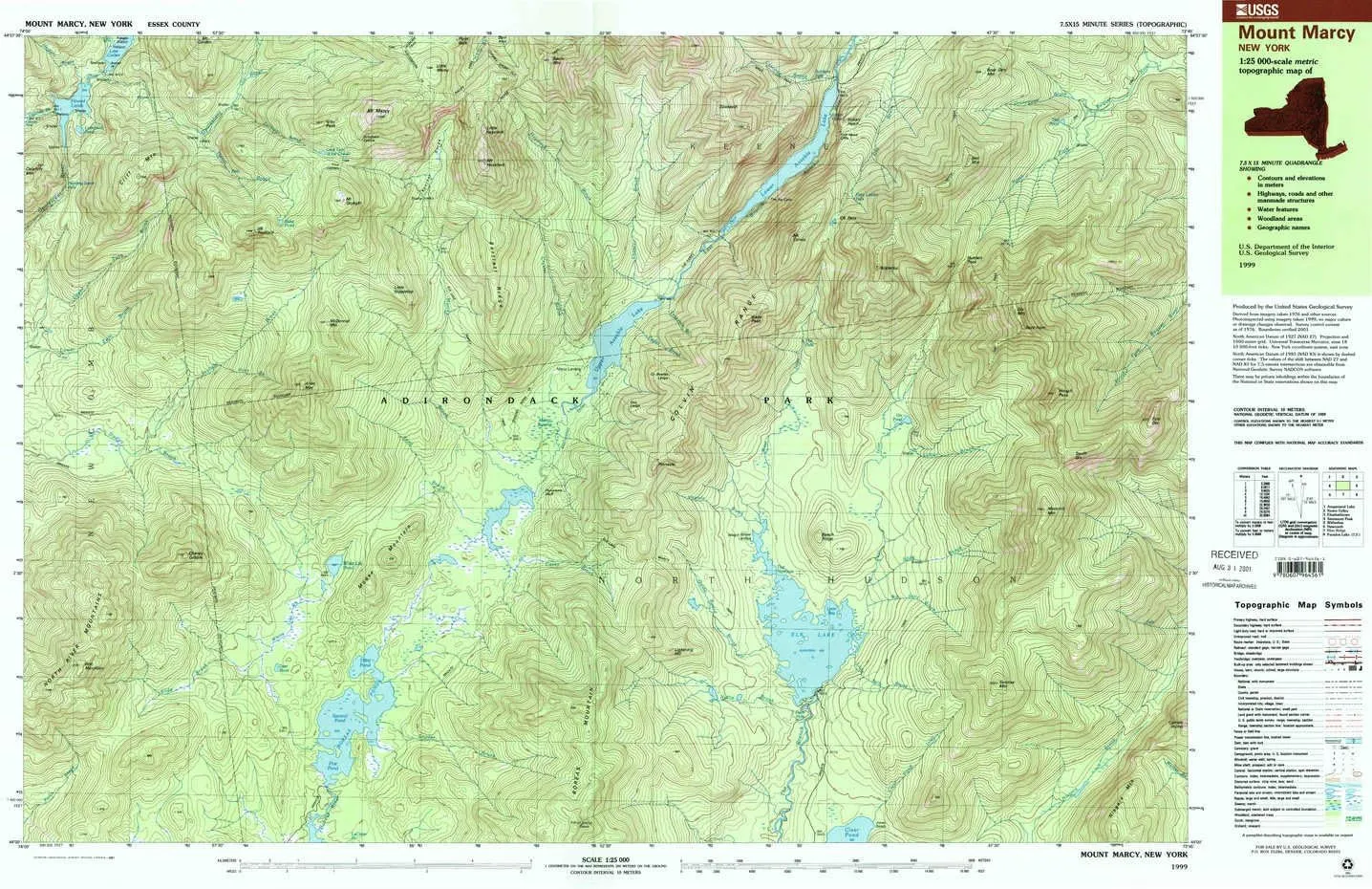
- USGS topographic map of Mount Marcy, NY, at 1:25000 scale. Heavier material. Waterproof. Tear-resistant. Foldable. Perfect for the outdoors.
- Cities, towns, villages: Please see map preview to find populated places, townships, as well as roads and street names if available.
- Islands: Consult topo map preview for visible islands.
- Parks and forests: National Parks, National Forests, etc. Please preview map image for specifics.
USGS topographic map of Mount Marcy, New York, dated 1999, updated 2001.
Includes geographic coordinates (latitude and longitude), lines of elevation, bodies of water, roads, and more. This topo quad is suitable for recreational, outdoor uses, office applications, or wall map framing.
Printed on-demand by YellowMaps on the print material of your choice.
Shipping rolled from Minneapolis, MN, United States.
Product Number: USGS-5455133
Map Size: 24 inches high x 38.9 inches wide
Map Scale: 1:25000
Map Type: POD USGS Topographic Map
Map Series: HTMC
Map Version: Historical
Cell ID: 75242
Scan ID: 137391
Imprint Year: 2001
Woodland Tint: Yes
Visual Version Number: 1
Photo Inspection Year: 1999
Aerial Photo Year: 1976
Datum: NAD27
Map Projection: Universal Transverse Mercator
Map published by United States Geological Survey
Map Language: English
Scanner Resolution: 600 dpi
Map Cell Name: Mount Marcy
Grid size: 7.5 X 15 Minute
Date on map: 1999
Geographical region: New York, United States
Northern map edge Latitude: 44.125°
Southern map edge Latitude: 44°
Western map edge Longitude: -74°
Eastern map edge Longitude: -73.75°
Surrounding map sheets (copy & paste the Product No. in the search bar):
North: USGS-5455097,USGS-5455099,USGS-5455101
East: USGS-5451441,USGS-5451459,USGS-5451439,USGS-5451461,USGS-5451433
South: USGS-5453797,USGS-5453793,USGS-5453809,USGS-5454855,USGS-5454761
West: USGS-5453639,USGS-5453657,USGS-5453661,USGS-5455179,USGS-5453653


![Temdan for Samsung Galaxy S24 FE Case Waterproof, [Military-Grade Drop Protection] [IP68 Underwater] Full Body Heavy Duty Rugged Shock-Proof Case for S24 FE 6.7''-Teal](https://www.flintstart.shop/image/temdan-for-samsung-galaxy-s24-fe-case-waterproof-military-grade-drop-protection-ip68-underwater-full-body-heavy-duty-rugged-shock-proof-case-for-s24-fe-67-teal_O1nbwT_300x.webp "Temdan for Samsung Galaxy S24 FE Case Waterproof, [Military-Grade Drop Protection] [IP68 Underwater] Full Body Heavy Duty Rugged Shock-Proof Case for S24 FE 6.7''-Teal")


