- Printed on Polypropylene (plastic)
- USGS topographic map of Moccasin Lake, WY, at 1:62500 scale. Heavier material. Waterproof. Tear-resistant. Foldable. Perfect for the outdoors.
- Cities, towns, villages: Please see map preview to find populated places, townships, as well as roads and street names if available.
- Islands: Consult topo map preview for visible islands.
- Parks and forests: National Parks, National Forests, etc. Please preview map image for specifics.
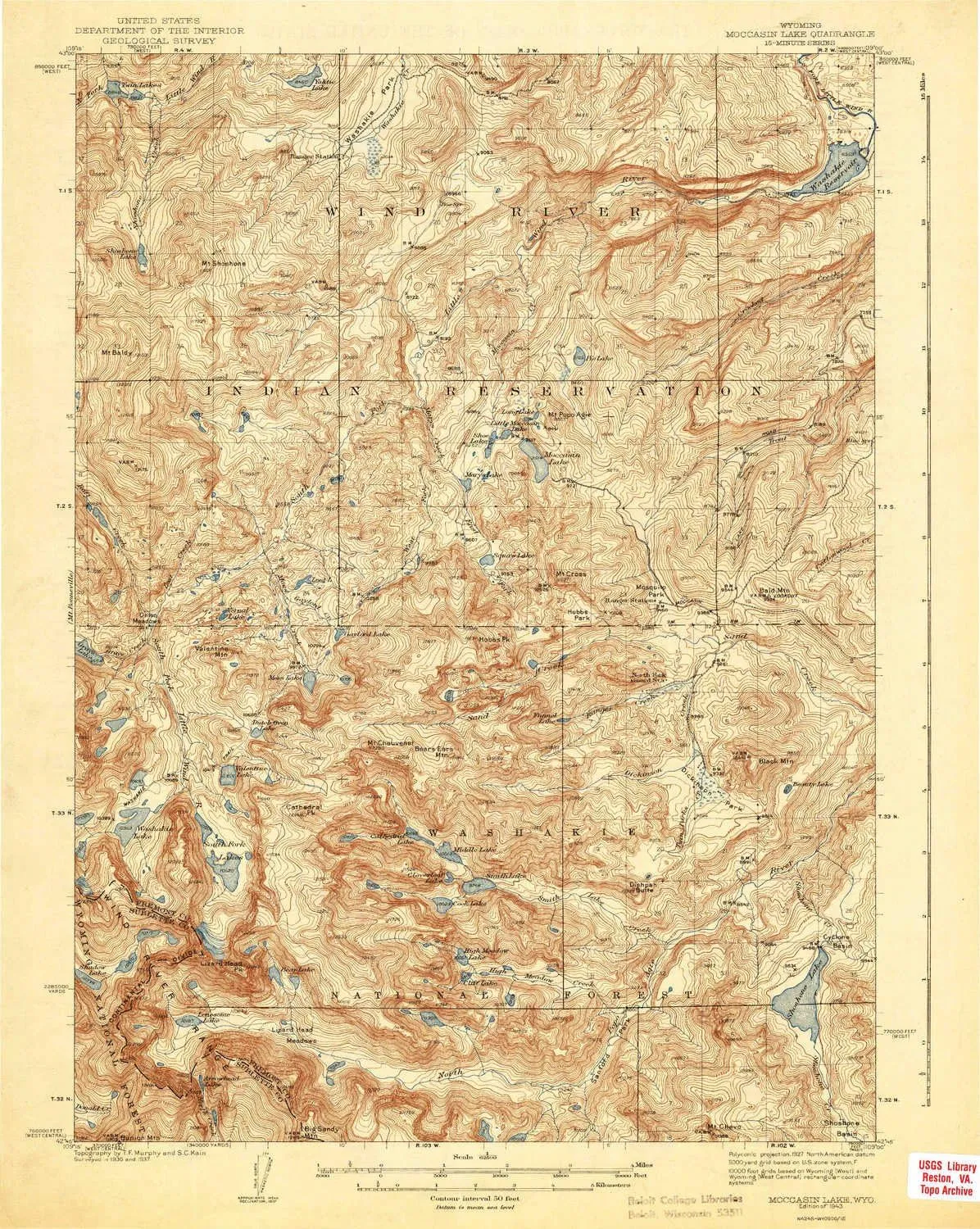
USGS topographic map of Moccasin Lake, Wyoming, dated 1943.
Includes geographic coordinates (latitude and longitude), lines of elevation, bodies of water, roads, and more. This topo quad is suitable for recreational, outdoor uses, office applications, or wall map framing.
Printed on-demand by YellowMaps on the print material of your choice.
Shipping rolled from Minneapolis, MN, United States.
Product Number: USGS-5617328
Map Size: 19.8 inches high x 15.8 inches wide
Map Scale: 1:62500
Map Type: POD USGS Topographic Map
Map Series: HTMC
Map Version: Historical
Cell ID: 57748
Scan ID: 342179
Survey Year: 1937
Datum: NAD27
Map Projection: Polyconic
Map published by United States Geological Survey
Map Language: English
Scanner Resolution: 600 dpi
Map Cell Name: Moccasin Lake
Grid size: 15 X 15 Minute
Date on map: 1943
Geographical region: Wyoming, United States
Northern map edge Latitude: 43°
Southern map edge Latitude: 42.75°
Western map edge Longitude: -109.25°
Eastern map edge Longitude: -109°
Surrounding map sheets (copy & paste the Product No. in the search bar):
North: USGS-5616040,USGS-5616042,USGS-5616044,USGS-5616046
East: USGS-5614096,USGS-5614088,USGS-5614094,USGS-5614092,USGS-5614090
South: USGS-5616270,USGS-5616274,USGS-5616272
West: USGS-5617342,USGS-5614102,USGS-5614110,USGS-5614106,USGS-5617358
 - Defender Series Case - Forest Ranger - Rugged & Durable - with Port Protection - Holster Clip Includes - Microbial Defense Protection")


")


 Grey/Black")


