- Printed on Polypropylene (plastic)
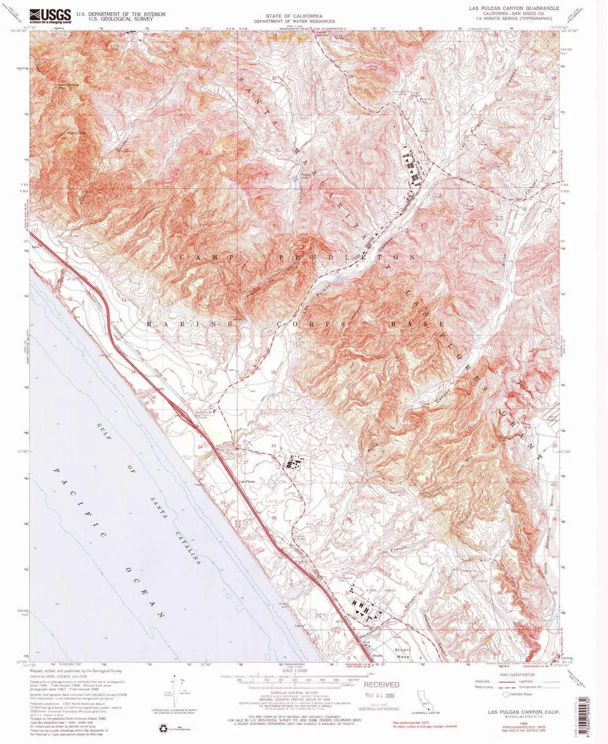
- USGS topographic map of Las Pulgas Canyon, CA, at 1:24000 scale. Heavier material. Waterproof. Tear-resistant. Foldable. Perfect for the outdoors.
- Cities, towns, villages: Las Flores,Don (historical),Stuart
- Islands: Consult topo map preview for visible islands.
- Parks and forests: National Parks, National Forests, etc. Please preview map image for specifics.
USGS topographic map of Las Pulgas Canyon, California, dated 1968, updated 1982.
Includes geographic coordinates (latitude and longitude), lines of elevation, bodies of water, roads, and more. This topo quad is suitable for recreational, outdoor uses, office applications, or wall map framing.
Printed on-demand by YellowMaps on the print material of your choice.
Shipping rolled from Minneapolis, MN, United States.
Product Number: USGS-5517013
Map Size: 26.8 inches high x 22 inches wide
Map Scale: 1:24000
Map Type: POD USGS Topographic Map
Map Series: HTMC
Map Version: Historical
Cell ID: 25011
Scan ID: 292164
Imprint Year: 1982
Woodland Tint: Yes
Visual Version Number: 1
Photo Inspection Year: 1975
Aerial Photo Year: 1967
Field Check Year: 1968
Datum: NAD27
Map Projection: Polyconic
Map Language: English
Scanner Resolution: 600 dpi
Map Cell Name: Las Pulgas Canyon
Grid size: 7.5 X 7.5 Minute
Date on map: 1968
Geographical region: California, United States
Northern map edge Latitude: 33.375°
Southern map edge Latitude: 33.25°
Western map edge Longitude: -117.5°
Eastern map edge Longitude: -117.375°
Surrounding map sheets (copy & paste the Product No. in the search bar):
North: USGS-5518071,USGS-5518069,USGS-5518073,USGS-5518075,USGS-5518061
East: USGS-5518859,USGS-5518865,USGS-5518867,USGS-5518863,USGS-5518861
South: USGS-5519815,USGS-5503323,USGS-5503313,USGS-5503333,USGS-5503317
West: USGS-5522591,USGS-5522593,USGS-5522587,USGS-5522589,USGS-5522585


 5G")


")

 - Defender Series Case - Black - Case Only - Screenless - Rugged & Durable - with Port Protection - Microbial Defense Protection")
