- Printed on Polypropylene (plastic)
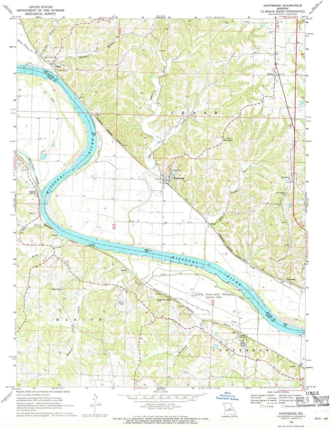
- USGS topographic map of Hartsburg, MO, at 1:24000 scale. Heavier material. Waterproof. Tear-resistant. Foldable. Perfect for the outdoors.
- Cities, towns, villages: Stonesport (historical),Wilton,Eureka (historical),Burlington (historical),Claysville,Oldham,Marion,Hartsburg
- Islands: Stanley Island,Fox Island
- Parks and forests: National Parks, National Forests, etc. Please preview map image for specifics.
USGS topographic map of Hartsburg, Missouri, dated 1969, updated 1971.
Includes geographic coordinates (latitude and longitude), lines of elevation, bodies of water, roads, and more. This topo quad is suitable for recreational, outdoor uses, office applications, or wall map framing.
Printed on-demand by YellowMaps on the print material of your choice.
Shipping rolled from Minneapolis, MN, United States.
Product Number: USGS-5578122
Map Size: 26.9 inches high x 22 inches wide
Map Scale: 1:24000
Map Type: POD USGS Topographic Map
Map Series: HTMC
Map Version: Historical
Cell ID: 70324
Scan ID: 322902
Imprint Year: 1971
Woodland Tint: Yes
Aerial Photo Year: 1967
Survey Year: 1969
Datum: NAD27
Map Projection: Polyconic
Map published by United States Geological Survey
Map Language: English
Scanner Resolution: 600 dpi
Map Cell Name: Hartsburg
Grid size: 7.5 X 7.5 Minute
Date on map: 1969
Geographical region: Missouri, United States
Northern map edge Latitude: 38.75°
Southern map edge Latitude: 38.625°
Western map edge Longitude: -92.375°
Eastern map edge Longitude: -92.25°
Surrounding map sheets (copy & paste the Product No. in the search bar):
North: USGS-5576100,USGS-5576098
East: USGS-5578446,USGS-5578438,USGS-5578440,USGS-5578444,USGS-5578442
South: USGS-5578934,USGS-5578930,USGS-5578932
West: USGS-5576812


![OBEX Waterproof Case and Removable Belt-Clip Holster Combo for the iPhone 6 Plus/6s Plus [Drop Proof] - Retail Packaging -Black/Gray](https://www.flintstart.shop/image/obex-waterproof-case-and-removable-belt-clip-holster-combo-for-the-iphone-6-plus6s-plus-drop-proof-retail-packaging-blackgray_b8tHld_300x.webp "OBEX Waterproof Case and Removable Belt-Clip Holster Combo for the iPhone 6 Plus/6s Plus [Drop Proof] - Retail Packaging -Black/Gray")


