- Printed on Polypropylene (plastic)
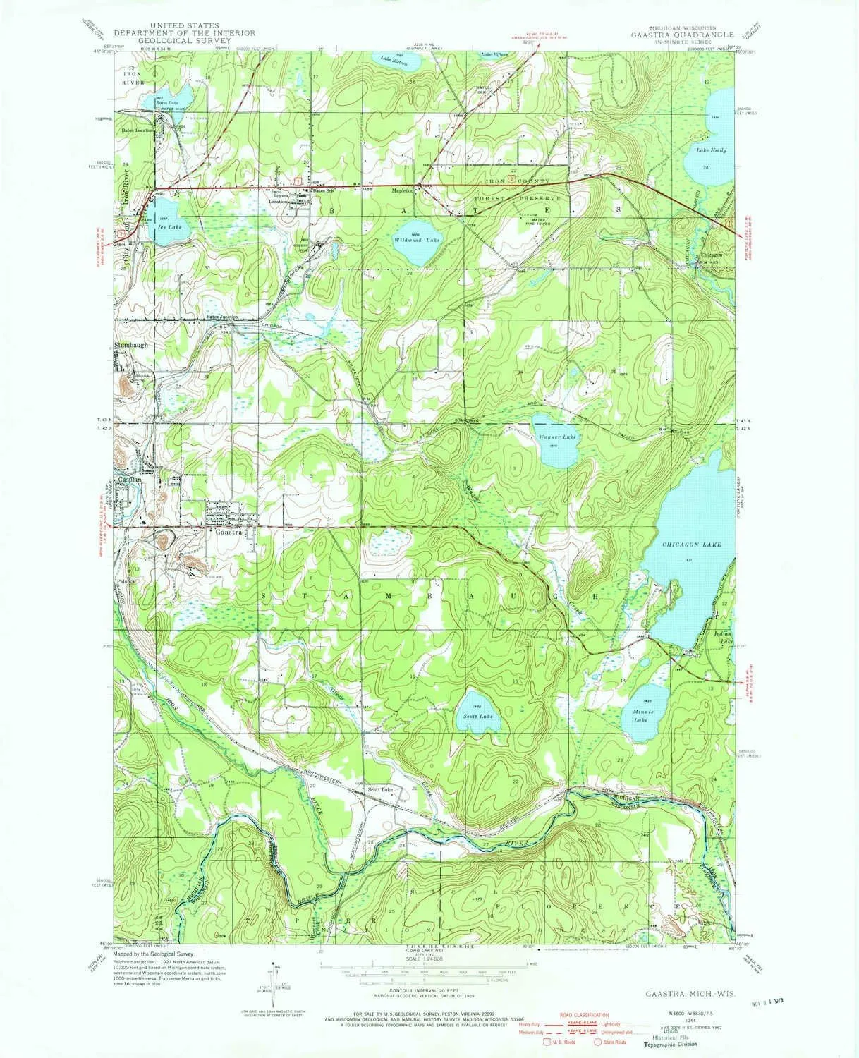
- USGS topographic map of Gaastra, MI, at 1:24000 scale. Heavier material. Waterproof. Tear-resistant. Foldable. Perfect for the outdoors.
- Cities, towns, villages: Chicagon,Gaastra,Rogers Location,Palatka,Mapleton,Bates Junction,Scott Lake,Bates Location
- Islands: Consult topo map preview for visible islands.
- Parks and forests: Ice Lake Park,Indian Village Historical Marker,Brule River Cliffs State Natural Area,Pentoga Park,First Roadside Park Historical Marker
USGS topographic map of Gaastra, Michigan, dated 1944, updated 1976.
Includes geographic coordinates (latitude and longitude), lines of elevation, bodies of water, roads, and more. This topo quad is suitable for recreational, outdoor uses, office applications, or wall map framing.
Printed on-demand by YellowMaps on the print material of your choice.
Shipping rolled from Minneapolis, MN, United States.
Product Number: USGS-5439044
Map Size: 27 inches high x 21.9 inches wide
Map Scale: 1:24000
Map Type: POD USGS Topographic Map
Map Series: HTMC
Map Version: Historical
Cell ID: 16603
Scan ID: 276144
Imprint Year: 1976
Woodland Tint: Yes
Datum: NAD27
Map Projection: Polyconic
Map published by United States Geological Survey
Map Language: English
Scanner Resolution: 600 dpi
Map Cell Name: Gaastra
Grid size: 7.5 X 7.5 Minute
Date on map: 1944
Geographical region: Michigan, United States
Northern map edge Latitude: 46.125°
Southern map edge Latitude: 46°
Western map edge Longitude: -88.625°
Eastern map edge Longitude: -88.5°
Surrounding map sheets (copy & paste the Product No. in the search bar):
North: USGS-5441326,USGS-5441328,USGS-5442302,USGS-5441330,USGS-5441332
East: USGS-5442126,USGS-5442526,USGS-5442528,USGS-5439022,USGS-5439020
South: USGS-5998898
West: USGS-5442188,USGS-5439500,USGS-5439498,USGS-5439502


 Carrying Case (Light Green) GameCard Case (Hello Kitty & Friends Stickers)")


")
