- Printed on Polypropylene (plastic)
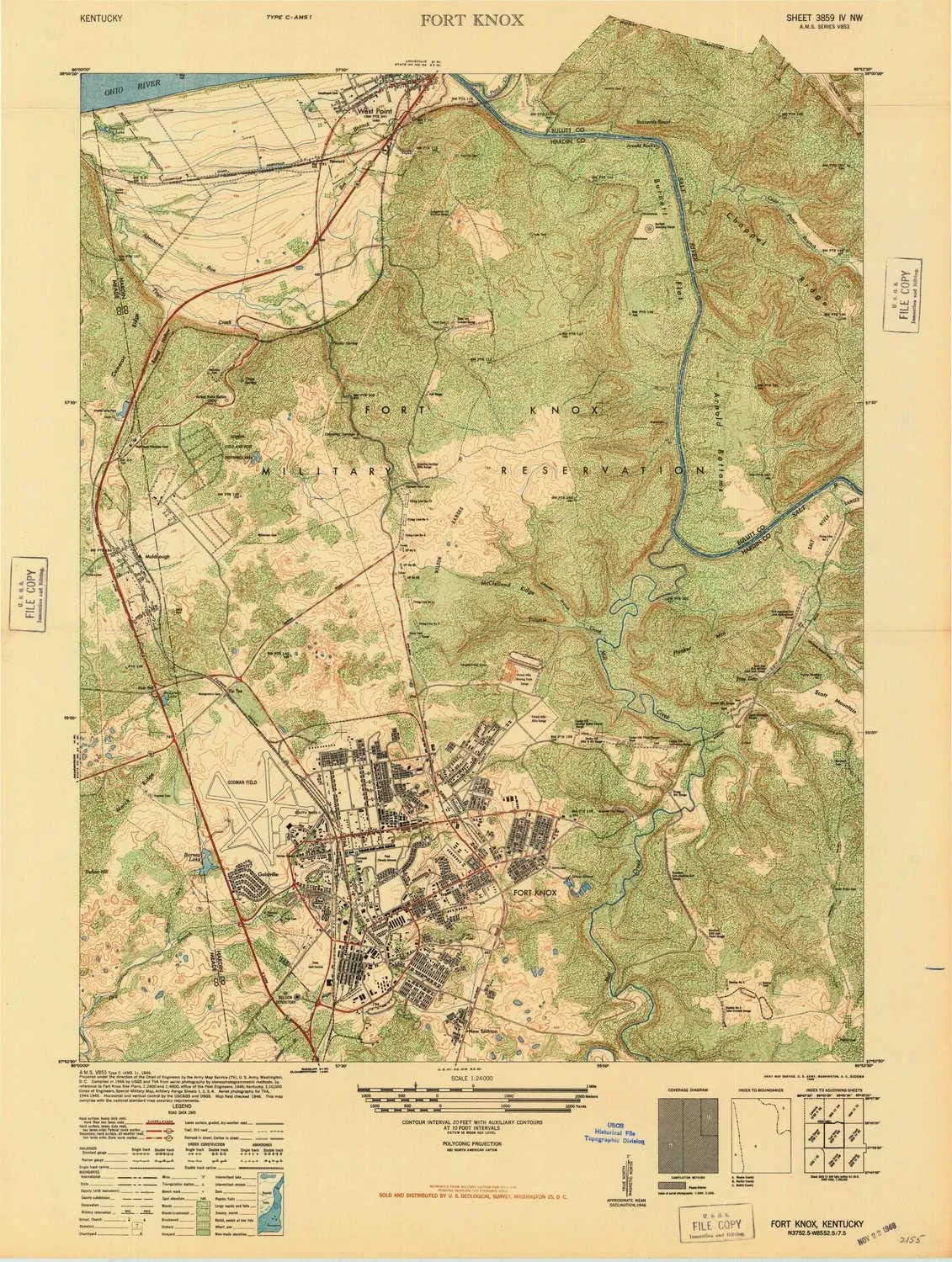
- USGS topographic map of Fort Knox, KY, at 1:24000 scale. Heavier material. Waterproof. Tear-resistant. Foldable. Perfect for the outdoors.
- Cities, towns, villages: Van Voorhis Manor,West Point,Howard,Prichard Place,Gaffey Heights,Rose Terrace,Muldraugh
- Islands: Consult topo map preview for visible islands.
- Parks and forests: Turret Field,Heard Park,Fort Hill City Park,Cornwell Field,Thorne Park
USGS topographic map of Fort Knox, Kentucky, dated 1946.
Includes geographic coordinates (latitude and longitude), lines of elevation, bodies of water, roads, and more. This topo quad is suitable for recreational, outdoor uses, office applications, or wall map framing.
Printed on-demand by YellowMaps on the print material of your choice.
Shipping rolled from Minneapolis, MN, United States.
Product Number: USGS-5676914
Map Size: 29.1 inches high x 21.9 inches wide
Map Scale: 1:24000
Map Type: POD USGS Topographic Map
Map Series: HTMC
Map Version: Historical
Cell ID: 15931
Scan ID: 803531
Woodland Tint: Yes
Aerial Photo Year: 1945
Field Check Year: 1946
Datum: NAD27
Map Projection: Polyconic
Map published by United States Army Corps of Engineers
Map published by United States Army
Keywords: Overedge
Map Language: English
Scanner Resolution: 508 dpi
Map Cell Name: Fort Knox
Grid size: 7.5 X 7.5 Minute
Date on map: 1946
Geographical region: Kentucky, United States
Northern map edge Latitude: 38°
Southern map edge Latitude: 37.875°
Western map edge Longitude: -86°
Eastern map edge Longitude: -85.875°
Surrounding map sheets (copy & paste the Product No. in the search bar):
North: USGS-5294482,USGS-5286398,USGS-5294836,USGS-5286406,USGS-5286402
East: USGS-5292986,USGS-5292988,USGS-5292990,USGS-5292992,USGS-5689280
South: USGS-5293958,USGS-5293966,USGS-5293960,USGS-5293964,USGS-5293968
West: USGS-5293212,USGS-5293214,USGS-5293210,USGS-5293208,USGS-5293206
")


 - with Cleaning Cloth - Retail Packaging - Chalk It Up")


