- Printed on Polypropylene (plastic)
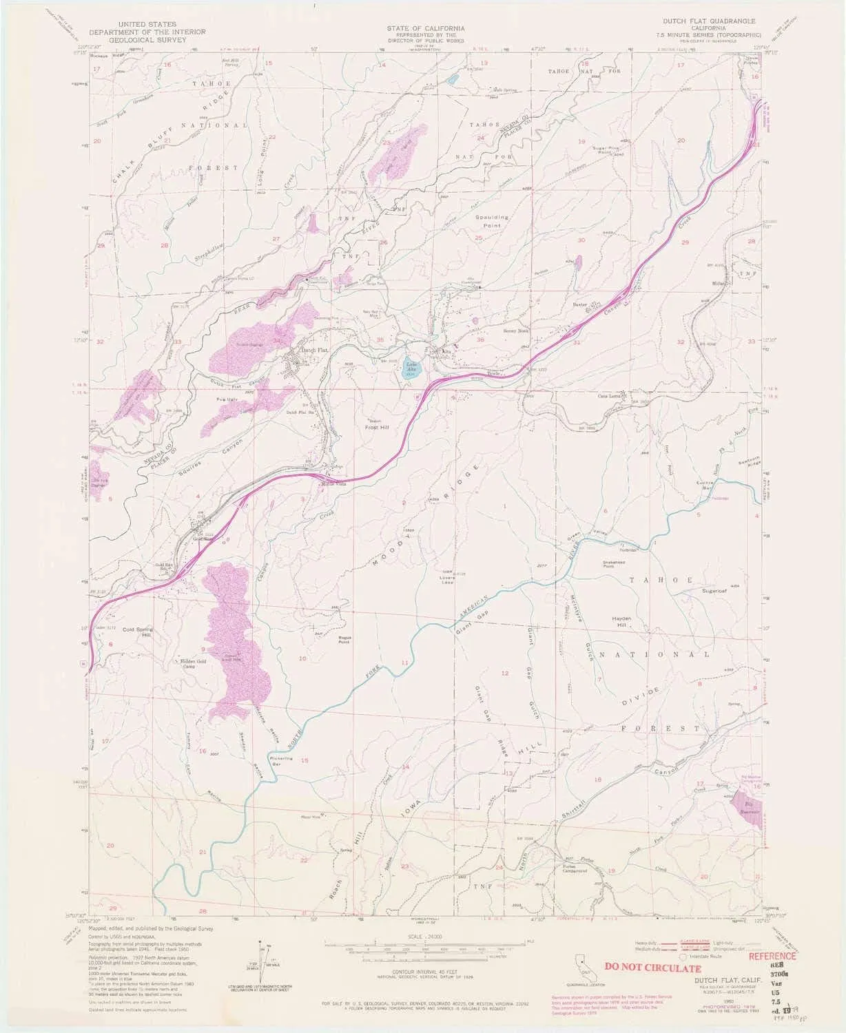
- USGS topographic map of Dutch Flat, CA, at 1:24000 scale. Heavier material. Waterproof. Tear-resistant. Foldable. Perfect for the outdoors.
- Cities, towns, villages: Baxter,Monte Vista,Alta,Dutch Flat,Casa Loma,Gold Run,Towle,Midas,Drum (historical)
- Islands: Consult topo map preview for visible islands.
- Parks and forests: National Parks, National Forests, etc. Please preview map image for specifics.
USGS topographic map of Dutch Flat, California, dated 1950, updated 1980.
Includes geographic coordinates (latitude and longitude), lines of elevation, bodies of water, roads, and more. This topo quad is suitable for recreational, outdoor uses, office applications, or wall map framing.
Printed on-demand by YellowMaps on the print material of your choice.
Shipping rolled from Minneapolis, MN, United States.
Product Number: USGS-5512959
Map Size: 27.2 inches high x 22.3 inches wide
Map Scale: 1:24000
Map Type: POD USGS Topographic Map
Map Series: HTMC
Map Version: Historical
Cell ID: 13161
Scan ID: 302967
Imprint Year: 1980
Visual Version Number: 1
Photo Revision Year: 1979
Aerial Photo Year: 1976
Edit Year: 1979
Field Check Year: 1950
Datum: NAD27
Map Projection: Polyconic
Planimetric: Yes
Map published by United States Geological Survey
Map Language: English
Scanner Resolution: 600 dpi
Map Cell Name: Dutch Flat
Grid size: 7.5 X 7.5 Minute
Date on map: 1950
Geographical region: California, United States
Northern map edge Latitude: 39.25°
Southern map edge Latitude: 39.125°
Western map edge Longitude: -120.875°
Eastern map edge Longitude: -120.75°
Surrounding map sheets (copy & paste the Product No. in the search bar):
North: USGS-5525659,USGS-5525651,USGS-5525653,USGS-5525647,USGS-5525649
East: USGS-5525997,USGS-5526003,USGS-5526007,USGS-5526005,USGS-5526009
South: USGS-5514013,USGS-5514017,USGS-5514025,USGS-5514021,USGS-5514019
West: USGS-5510693,USGS-5510679,USGS-5510681,USGS-5510691,USGS-5510685


, Glitter Crayons & Coloring Supplies, Kids Art Set, Gifts for Girls & Boys, Ages 5")


