- Printed on Tyvek® (synthetic)
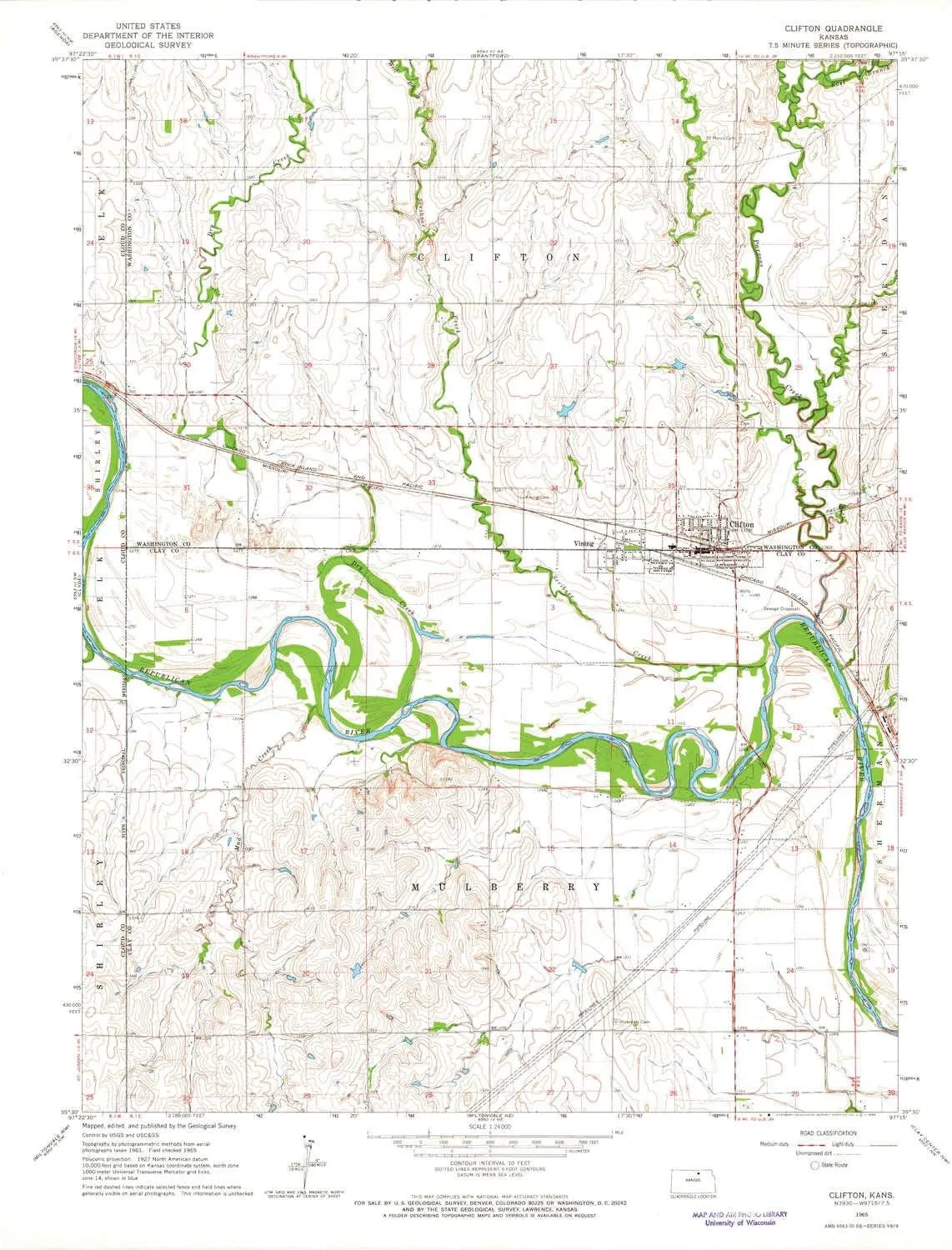
- USGS topographic map of Clifton, KS, at 1:24000 scale. Lighter material. Waterproof. Tear-resistant. Foldable. Very durable. Perfect for backpacking and the outdoors.
- Cities, towns, villages: Clifton,Vining
- Mountains: High elevation topographical features like high summits and peaks.
- Valleys: Low elevation topographic features such as flatlands, river valleys, and canyons.
USGS topographic map of Clifton, Kansas, dated 1965, updated 1966.
Includes geographic coordinates (latitude and longitude), lines of elevation, bodies of water, roads, and more. This topo quad is suitable for recreational, outdoor uses, office applications, or wall map framing.
Printed on-demand by YellowMaps on the print material of your choice.
Shipping rolled from Minneapolis, MN, United States.
Product Number: USGS-5970356
Map Size: 27.03 inches high x 21.03 inches wide
Map Scale: 1:24000
Map Type: POD USGS Topographic Map
Map Series: HTMC
Map Version: Historical
Cell ID: 9173
Scan ID: 511084
Imprint Year: 1966
Woodland Tint: Yes
Aerial Photo Year: 1961
Field Check Year: 1965
Datum: NAD27
Map Projection: Polyconic
Map published by United States Geological Survey
Map Language: English
Scanner Resolution: 508 dpi
Map Cell Name: Clifton
Grid size: 7.5 X 7.5 Minute
Date on map: 1965
Geographical region: Kansas, United States
Northern map edge Latitude: 39.625°
Southern map edge Latitude: 39.5°
Western map edge Longitude: -97.375°
Eastern map edge Longitude: -97.25°
Surrounding map sheets (copy & paste the Product No. in the search bar):
North: USGS-5970032
East: USGS-5972208
South: USGS-5972576
West: USGS-5970370


