- Printed on Tyvek® (synthetic)
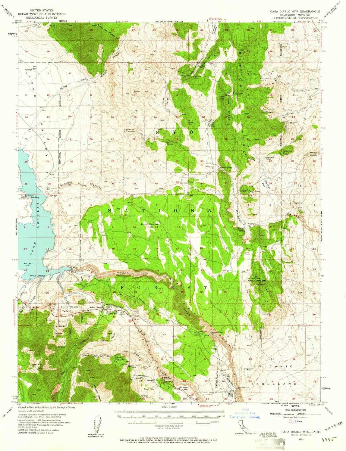
- USGS topographic map of Casa Diablo Mtn, CA, at 1:62500 scale. Lighter material. Waterproof. Tear-resistant. Foldable. Very durable. Perfect for backpacking and the outdoors.
- Cities, towns, villages: Toms Place,South Landing,Aspen Springs,North Landing,Mesa Camp
- Mountains: Red Mountain,Round Mountain,Casa Diablo Mountain
- Valleys: Watterson Canyon,Whisky Canyon,Sand Canyon,Wilfred Canyon,Wildrose Canyon
USGS topographic map of Casa Diablo Mtn, California, dated 1953, updated 1961.
Includes geographic coordinates (latitude and longitude), lines of elevation, bodies of water, roads, and more. This topo quad is suitable for recreational, outdoor uses, office applications, or wall map framing.
Printed on-demand by YellowMaps on the print material of your choice.
Shipping rolled from Minneapolis, MN, United States.
Product Number: USGS-5500989
Map Size: 20.8 inches high x 16.6 inches wide
Map Scale: 1:62500
Map Type: POD USGS Topographic Map
Map Series: HTMC
Map Version: Historical
Cell ID: 52236
Scan ID: 297045
Imprint Year: 1961
Woodland Tint: Yes
Aerial Photo Year: 1951
Field Check Year: 1953
Datum: NAD27
Map Projection: Polyconic
Map published by United States Geological Survey
Map Language: English
Scanner Resolution: 600 dpi
Map Cell Name: Casa Diablo Mountain
Grid size: 15 X 15 Minute
Date on map: 1953
Geographical region: California, United States
Northern map edge Latitude: 37.75°
Southern map edge Latitude: 37.5°
Western map edge Longitude: -118.75°
Eastern map edge Longitude: -118.5°
Surrounding map sheets (copy & paste the Product No. in the search bar):
North: USGS-5514523,USGS-5501919,USGS-5501921,USGS-5514521
East: USGS-5506441,USGS-5506447,USGS-5510717,USGS-5506437,USGS-5506445
South: USGS-5503225,USGS-5503237,USGS-5503223,USGS-5503227,USGS-5503231
West: USGS-5511463,USGS-5511461,USGS-5503205,USGS-5503203,USGS-5503201


-Black")


")

