- Printed on Polypropylene (plastic)
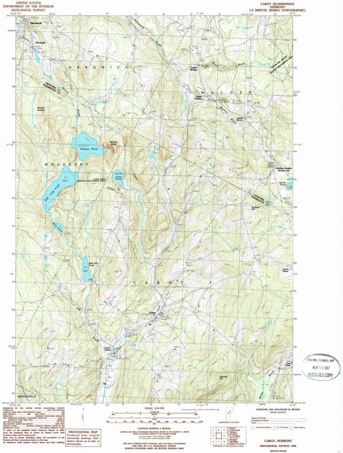
- USGS topographic map of Cabot, VT, at 1:24000 scale. Heavier material. Waterproof. Tear-resistant. Foldable. Perfect for the outdoors.
- Cities, towns, villages: Lower Cabot,South Walden,Cabot,Taylor Bridge,Walden Heights,Mackville,Smith Corner,East Cabot
- Islands: Consult topo map preview for visible islands.
- Parks and forests: Steam Mill Brook Wildlife Management Area
USGS topographic map of Cabot, Vermont, dated 1986, updated 1987.
Includes geographic coordinates (latitude and longitude), lines of elevation, bodies of water, roads, and more. This topo quad is suitable for recreational, outdoor uses, office applications, or wall map framing.
Printed on-demand by YellowMaps on the print material of your choice.
Shipping rolled from Minneapolis, MN, United States.
Product Number: USGS-5599262
Map Size: 26.7 inches high x 22 inches wide
Map Scale: 1:24000
Map Type: POD USGS Topographic Map
Map Series: HTMC
Map Version: Historical
Cell ID: 6597
Scan ID: 337356
Imprint Year: 1987
Woodland Tint: Yes
Aerial Photo Year: 1980
Edit Year: 1986
Field Check Year: 1982
Datum: NAD27
Map Projection: Universal Transverse Mercator
Provisional map: Yes
Map published by United States Geological Survey
Map Language: English
Scanner Resolution: 600 dpi
Map Cell Name: Cabot
Grid size: 7.5 X 7.5 Minute
Date on map: 1986
Geographical region: Vermont, United States
Northern map edge Latitude: 44.5°
Southern map edge Latitude: 44.375°
Western map edge Longitude: -72.375°
Eastern map edge Longitude: -72.25°
Surrounding map sheets (copy & paste the Product No. in the search bar):
North: USGS-5599264,USGS-5599266
East: USGS-5600018,USGS-5600016
South: USGS-5599536
West: USGS-5599956,USGS-5599954


