- Printed on Tyvek® (synthetic)
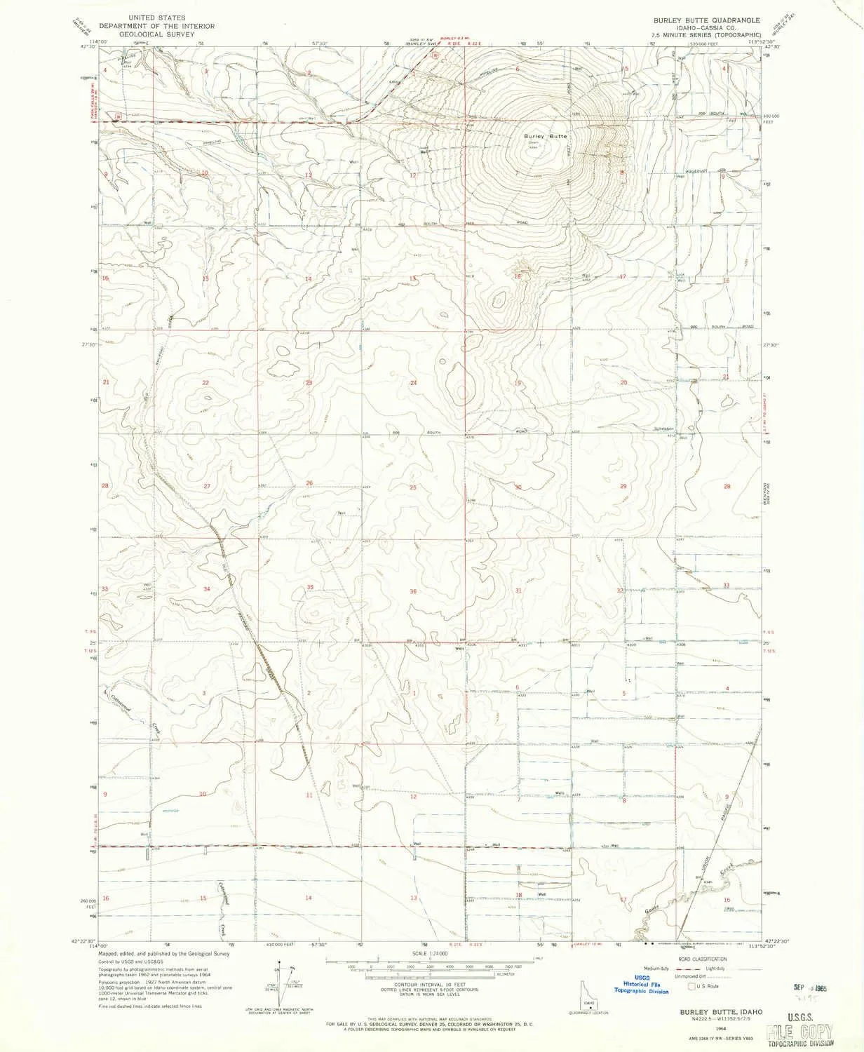
- USGS topographic map of Burley Butte, ID, at 1:24000 scale. Lighter material. Waterproof. Tear-resistant. Foldable. Very durable. Perfect for backpacking and the outdoors.
- Cities, towns, villages: Please see map preview to find populated places, townships, as well as roads and street names if available.
- Mountains: Burley Butte
- Valleys: Low elevation topographic features such as flatlands, river valleys, and canyons.
USGS topographic map of Burley Butte, Idaho, dated 1964, updated 1965.
Includes geographic coordinates (latitude and longitude), lines of elevation, bodies of water, roads, and more. This topo quad is suitable for recreational, outdoor uses, office applications, or wall map framing.
Printed on-demand by YellowMaps on the print material of your choice.
Shipping rolled from Minneapolis, MN, United States.
Product Number: USGS-5430952
Map Size: 26.8 inches high x 22 inches wide
Map Scale: 1:24000
Map Type: POD USGS Topographic Map
Map Series: HTMC
Map Version: Historical
Cell ID: 6257
Scan ID: 235507
Imprint Year: 1965
Aerial Photo Year: 1962
Survey Year: 1964
Datum: NAD27
Map Projection: Polyconic
Map published by United States Geological Survey
Map Language: English
Scanner Resolution: 600 dpi
Map Cell Name: Burley Butte
Grid size: 7.5 X 7.5 Minute
Date on map: 1964
Geographical region: Idaho, United States
Northern map edge Latitude: 42.5°
Southern map edge Latitude: 42.375°
Western map edge Longitude: -114°
Eastern map edge Longitude: -113.875°
Surrounding map sheets (copy & paste the Product No. in the search bar):
North: USGS-5430966,USGS-5430964,USGS-5437110
East: USGS-5433002,USGS-5433000
South: USGS-5433510,USGS-5433508
West: USGS-5433724,USGS-5433722


 Fits Pottery Barn PB Comfort Roll ARM Sofa (Not Grand Sofa). A Durable Slipcover Replacement (Polyester Flax Gray Box Edge)")


