- Printed on Polypropylene (plastic)
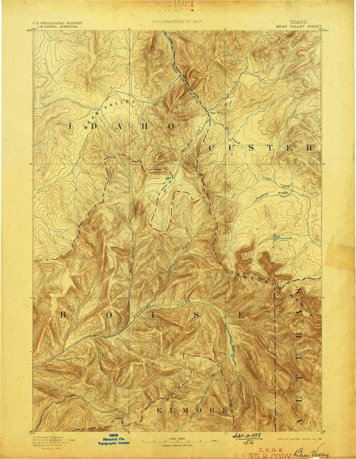
- USGS topographic map of Bear Valley, ID, at 1:125000 scale. Heavier material. Waterproof. Tear-resistant. Foldable. Perfect for the outdoors.
- Cities, towns, villages: Bear Creek Summer Home Area,Grandjean,Camp Creek Summer Home Area,Cape Horn (historical)
- Islands: Consult topo map preview for visible islands.
- Parks and forests: Langer Monument,South Fork Payette River Game Preserve
USGS topographic map of Bear Valley, Idaho, dated 1893, updated 1898.
Includes geographic coordinates (latitude and longitude), lines of elevation, bodies of water, roads, and more. This topo quad is suitable for recreational, outdoor uses, office applications, or wall map framing.
Printed on-demand by YellowMaps on the print material of your choice.
Shipping rolled from Minneapolis, MN, United States.
Product Number: USGS-5437192
Map Size: 20 inches high x 15.6 inches wide
Map Scale: 1:125000
Map Type: POD USGS Topographic Map
Map Series: HTMC
Map Version: Historical
Cell ID: 64964
Scan ID: 239450
Imprint Year: 1898
Survey Year: 1891
Datum: Unstated
Map Projection: Unstated
Map published by United States Geological Survey
Map Language: English
Scanner Resolution: 600 dpi
Map Cell Name: Bear Valley
Grid size: 30 X 30 Minute
Date on map: 1893
Geographical region: Idaho, United States
Northern map edge Latitude: 44.5°
Southern map edge Latitude: 44°
Western map edge Longitude: -115.5°
Eastern map edge Longitude: -115°
Surrounding map sheets (copy & paste the Product No. in the search bar):
North: USGS-5436690,USGS-5436692,USGS-5432610
East: USGS-5437254,USGS-5433948,USGS-5437256,USGS-5433956,USGS-5437252
South: USGS-5437346,USGS-5430470,USGS-5437348,USGS-5437350,USGS-5437352
West: USGS-5437258,USGS-5433406,USGS-5437260


