- Printed on Polypropylene (plastic)
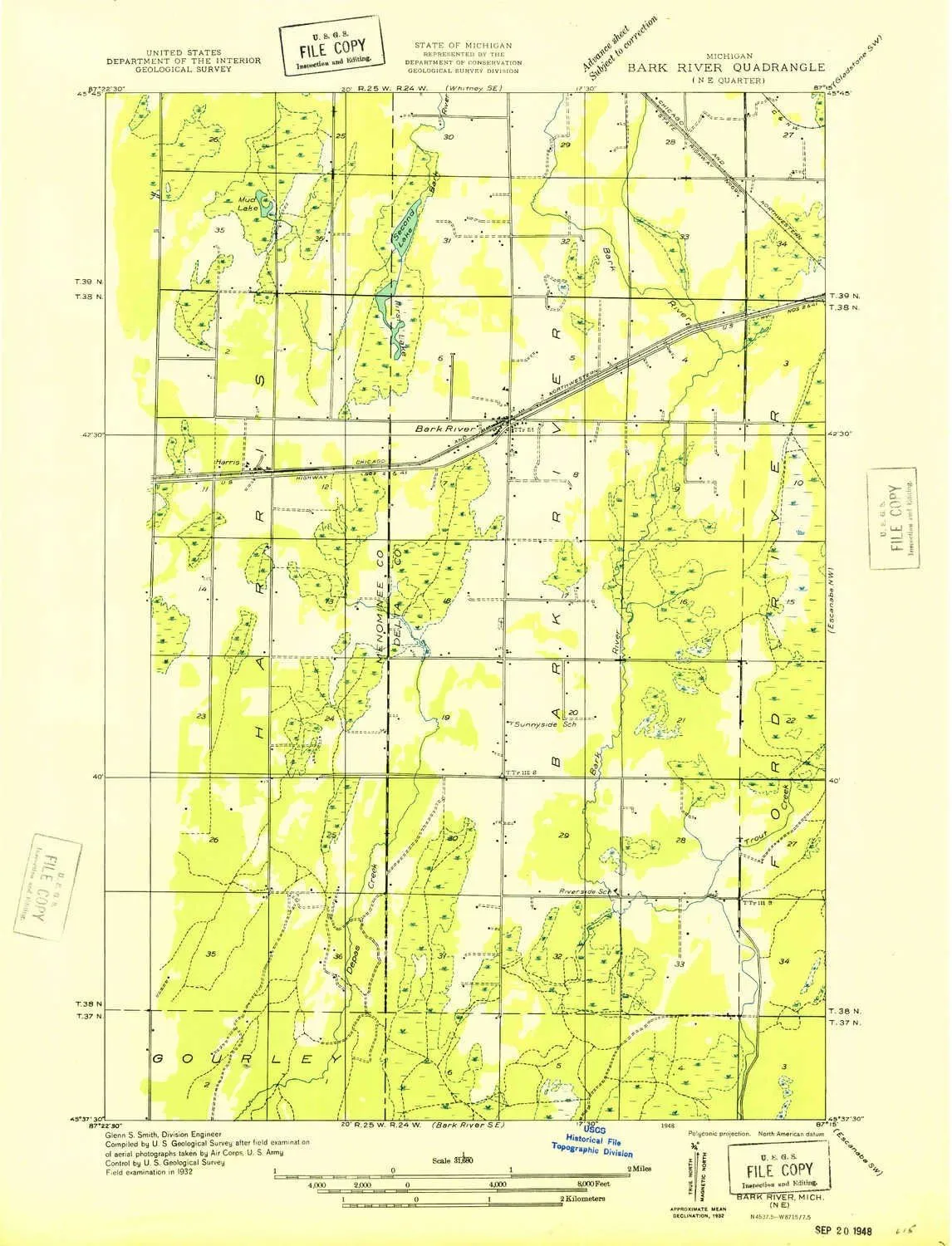
- USGS topographic map of Bark River NE, MI, at 1:31680 scale. Heavier material. Waterproof. Tear-resistant. Foldable. Perfect for the outdoors.
- Cities, towns, villages: Bark River,Harris,Hannahville
- Islands: Consult topo map preview for visible islands.
- Parks and forests: Pulaski Park
USGS topographic map of Bark River NE, Michigan, dated 1932.
Includes geographic coordinates (latitude and longitude), lines of elevation, bodies of water, roads, and more. This topo quad is suitable for recreational, outdoor uses, office applications, or wall map framing.
Printed on-demand by YellowMaps on the print material of your choice.
Shipping rolled from Minneapolis, MN, United States.
Product Number: USGS-5442068
Map Size: 20.9 inches high x 16 inches wide
Map Scale: 1:31680
Map Type: POD USGS Topographic Map
Map Series: HTMC
Map Version: Historical
Cell ID: 2403
Scan ID: 277754
Woodland Tint: Yes
Survey Year: 1932
Datum: NAD
Map Projection: Polyconic
Advance: Yes
Planimetric: Yes
Map published by United States Geological Survey
Map Language: English
Scanner Resolution: 600 dpi
Map Cell Name: Bark River
Grid size: 7.5 X 7.5 Minute
Date on map: 1932
Geographical region: Michigan, United States
Northern map edge Latitude: 45.75°
Southern map edge Latitude: 45.625°
Western map edge Longitude: -87.375°
Eastern map edge Longitude: -87.25°
Surrounding map sheets (copy & paste the Product No. in the search bar):
North: USGS-5440998,USGS-5442320
East: USGS-5439004
South: USGS-5441012
West: USGS-5441670
 - Defender Series Case - Realtree Blaze Edge (Camo) - Screenless - Rugged & Durable - with Port Protection - Holster Clip Includes - Microbial Defense Protection")


