- Printed on Polypropylene (plastic)
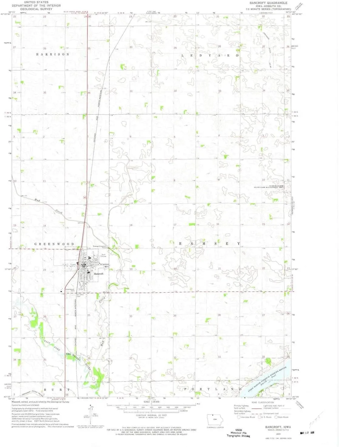
- USGS topographic map of Bancroft, IA, at 1:24000 scale. Heavier material. Waterproof. Tear-resistant. Foldable. Perfect for the outdoors.
- Cities, towns, villages: Bancroft
- Islands: Consult topo map preview for visible islands.
- Parks and forests: Union Slough National Wildlife Refuge,Kossuth County Waterfowl Production Area,Maynard Reese Area
USGS topographic map of Bancroft, Iowa, dated 1972, updated 1975.
Includes geographic coordinates (latitude and longitude), lines of elevation, bodies of water, roads, and more. This topo quad is suitable for recreational, outdoor uses, office applications, or wall map framing.
Printed on-demand by YellowMaps on the print material of your choice.
Shipping rolled from Minneapolis, MN, United States.
Product Number: USGS-6009063
Map Size: 27.08 inches high x 22.17 inches wide
Map Scale: 1:24000
Map Type: POD USGS Topographic Map
Map Series: HTMC
Map Version: Historical
Cell ID: 2309
Scan ID: 174139
Imprint Year: 1975
Woodland Tint: Yes
Aerial Photo Year: 1972
Field Check Year: 1972
Datum: NAD27
Map Projection: Lambert Conformal Conic
Map published by United States Geological Survey
Map Language: English
Scanner Resolution: 600 dpi
Map Cell Name: Bancroft
Grid size: 7.5 X 7.5 Minute
Date on map: 1972
Geographical region: Iowa, United States
Northern map edge Latitude: 43.375°
Southern map edge Latitude: 43.25°
Western map edge Longitude: -94.25°
Eastern map edge Longitude: -94.125°
Surrounding map sheets (copy & paste the Product No. in the search bar):
North: USGS-5282075
East: USGS-5281643
South: USGS-5280953
West: USGS-5280755


 Non-Retail Packaging - Limousine")


