- Printed on Tyvek® (synthetic)
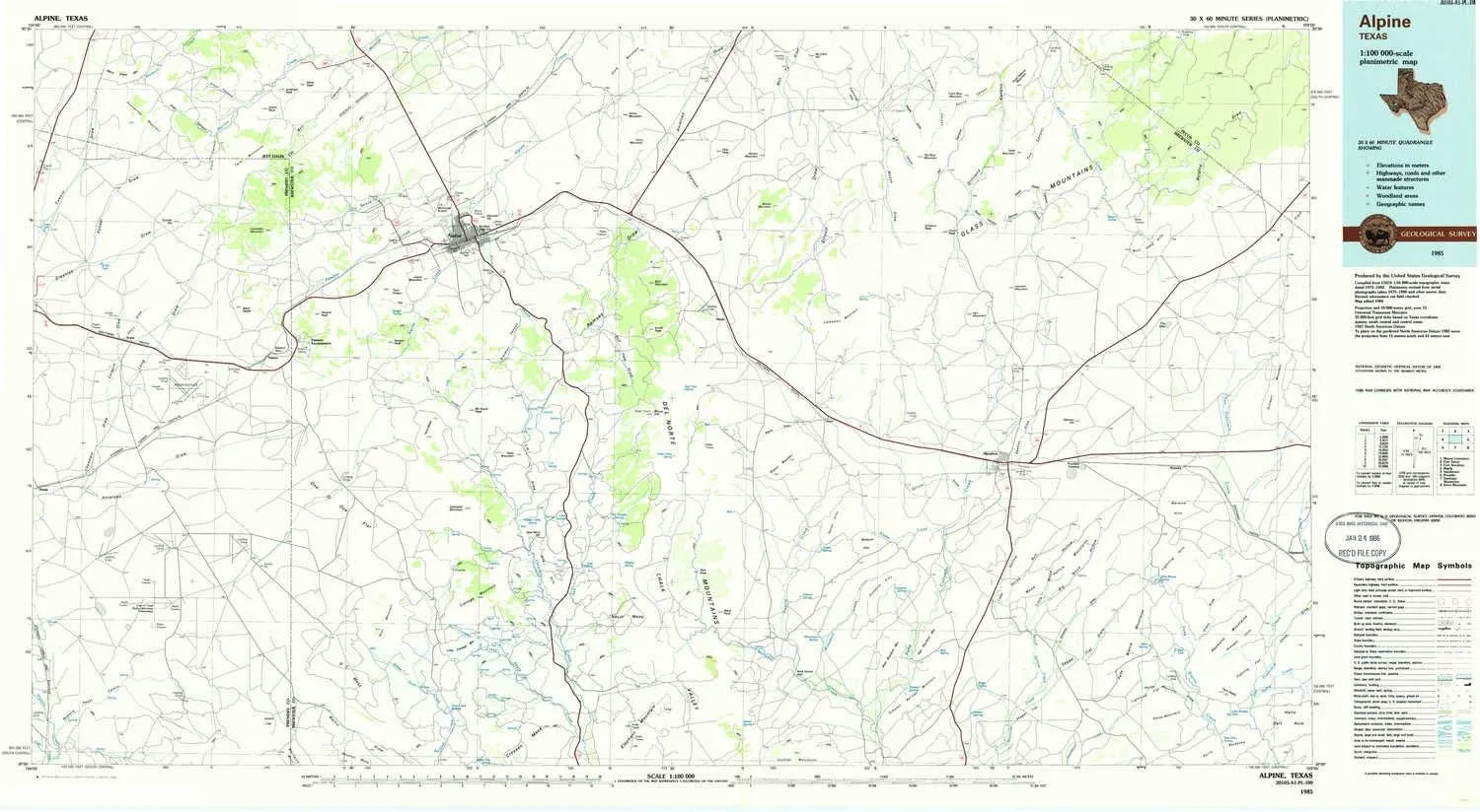
- USGS topographic map of Alpine, TX, at 1:100000 scale. Lighter material. Waterproof. Tear-resistant. Foldable. Very durable. Perfect for backpacking and the outdoors.
- Cities, towns, villages: Old Parker Place,Youngblood Place,Titley,Edwards Place,Louis Granger Place,Lenox,Bennett Place (historical),Kriebaum Place,Matthews Place,Mitchell Place,Walker Place,Ansley Place,Fourmile Crossing,Tinaja,Causey Place,Old Reed Place,Toronto,Shoemaker Place,Haymond,Old Oscar Nance Place,Alpine,Bennett Place (historical),Marathon,McFarland Place,Old Edith Lochausen Place,Bennett Place (historical),Old Corbett Place,Nopal,Altuda,Old Beekley Place,Beatty Pla
- Mountains: Del Norte Mountains,Glass Mountains,Nevill Mesa,Ranger Peak,Mount Ord,West Bourland Mountain,Haymond Mountains,Old Blue Mountain,Smith Peak,Alpine Hill,Warwick Hills,East Bourland Mountain,Horse Mountain,Terry Mesa,Crenshaw Mountain
- Valleys: Stump Canyon,Skinner Canyon,Spring Canyon,Jail Canyon,Stroud Draw,L-H Draw,Robbers Roost Canyon,Good Tank Draw,Spruce Draw,Hess Canyon,China Draw,Deer Lick Draw,Horse Mountain Draw,Willow Canyon
USGS topographic map of Alpine, Texas, dated 1985, updated 1985.
Includes geographic coordinates (latitude and longitude), lines of elevation, bodies of water, roads, and more. This topo quad is suitable for recreational, outdoor uses, office applications, or wall map framing.
Printed on-demand by YellowMaps on the print material of your choice.
Shipping rolled from Minneapolis, MN, United States.
Product Number: USGS-5479675
Map Size: 24.1 inches high x 43.9 inches wide
Map Scale: 1:100000
Map Type: POD USGS Topographic Map
Map Series: HTMC
Map Version: Historical
Cell ID: 67033
Scan ID: 121947
Imprint Year: 1985
Woodland Tint: Yes
Visual Version Number: 1
Aerial Photo Year: 1980
Edit Year: 1985
Datum: NAD27
Map Projection: Universal Transverse Mercator
Planimetric: Yes
Map published by United States Geological Survey
Map Language: English
Scanner Resolution: 600 dpi
Map Cell Name: Alpine
Grid size: 30 X 60 Minute
Date on map: 1985
Geographical region: Texas, United States
Northern map edge Latitude: 30.5°
Southern map edge Latitude: 30°
Western map edge Longitude: -104°
Eastern map edge Longitude: -103°
Surrounding map sheets (copy & paste the Product No. in the search bar):
North: USGS-5480463,USGS-5479855,USGS-5480465,USGS-5480459,USGS-5486191
East: USGS-5495275,USGS-5495277,USGS-5480107,USGS-5480595,USGS-5480109
South: USGS-5481007,USGS-5488215,USGS-5480113,USGS-5478685,USGS-5481003
West: USGS-5486355,USGS-5479963,USGS-5480597,USGS-5480601,USGS-5481053


![Zac Posen Jolene Cat Eye/Butterfly Shape 60s/70s Retro/Vintage Look American Fashion Designer Sunglasses [52-19-140, black satin]](https://www.flintstart.shop/image/zac-posen-jolene-cat-eyebutterfly-shape-60s70s-retrovintage-look-american-fashion-designer-sunglasses-52-19-140-black-satin_mYievg_300x.webp "Zac Posen Jolene Cat Eye/Butterfly Shape 60s/70s Retro/Vintage Look American Fashion Designer Sunglasses [52-19-140, black satin]")

")


